
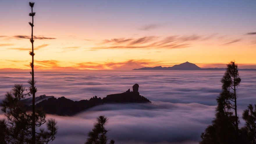
Predominance of cloudy skies with the opening of some clear in central hours in the north of the islands of greater relief this Thursday in Canary Islandsaccording to the forecast of the Meteorology Statal Agency (Aemet).
In the easternmost islands, cloudy intervals tending to slightly cloudy. In the rest of the areas, slightly cloudy or clear. During the second half of the day, there will be presence of high clouds that will affect the entire Archipelago.
Minimum temperatures with few changes, except for moderate rises in the midlands and summits of Tenerife. Highs in slight ascent, being able to be more pronounced in the middle and high areas.
Northeast wind, with strong intervals in inland areas of Lanzarote Y Fuerteventuraand on the northwest and southeast slopes of the remaining islands, especially during the first half of the day.
In the sea there will be a northeast component force 5 or 6 in the west and southeast, locally 7 offshore at dawn, and in the rest, 4 or 5. Strong swell, locally thick offshore in the west and southeast starting at dawn. On the southwest coast, variable 1 to 4 and rippled or tidal. Northwest or north swell of 1 to 2 meters.
FORECAST FOR THIS THURSDAY BY ISLANDS:
LANZAROTE
In the north, predominance of cloudy skies during the first half of the day, tending to slightly cloudy in the central hours and with cloudy intervals at the end. In the south, slightly cloudy or clear, with some cloudy intervals at the beginning. Presence of high clouds in the afternoon. Temperatures with little change. Northeast wind, more intense in interior areas, where strong intervals are expected, mainly during the first half of the day.
FORECAST MINIMUM AND MAXIMUM TEMPERATURES (°C):
Reef 16 25
FUERTEVENTURA
In the early hours, cloudy intervals in the north tending to slightly cloudy or clear. In the rest, a bit cloudy or clear. Presence of high clouds in the afternoon. Temperatures with few changes or slightly rising from the maximum in interior areas. Northeast wind, more intense in inland areas and on the southern slopes of the Jandía Peninsula, where strong intervals are expected during the first half of the day.
FORECAST MINIMUM AND MAXIMUM TEMPERATURES (°C):
Puerto del Rosario 16 24
GRAND CANARY
In the north, predominance of cloudy skies, opening clear in interior areas in central hours. In the rest, a bit cloudy or clear. Presence of high clouds during the second half of the day. Minimum temperatures with few changes and maximum temperatures in slight rise, being more pronounced in interior areas. Northeast wind, with strong intervals on the southeast and northwest slopes, and on the western tip, where there is a low probability of an occasional very strong gust, mainly in central hours. In summits it will be somewhat less intense. Breezes off the southwest coast.
FORECAST MINIMUM AND MAXIMUM TEMPERATURES (°C):
Las Palmas de Gran Canaria 15 22
TENERIFE
In the northeast, predominance of cloudy skies. In the north, cloudy intervals. In the rest, a bit cloudy or clear. Presence of high clouds during the second half of the day. Temperatures in slight rise, being more pronounced in the midlands and central peaks. Northeast wind, more intense in the extreme northwest and on the southeast slope, where strong intervals are expected in the first half of the day. In central peaks, light wind from north to northwest. Breezes off the southwest coast.
FORECAST MINIMUM AND MAXIMUM TEMPERATURES (°C):
Santa Cruz de Tenerife 17 24
LA GOMERA
In the north, predominance of cloudy skies, being able to open clear in central hours. In the rest, a bit cloudy or clear. Presence of high clouds during the second half of the day. Temperatures with few changes or slightly rising from the maximum in interior areas. Northeast wind, more intense on the northwest and east slopes, where strong intervals are expected in the first half of the day. In summits it will be somewhat less intense. Breezes off the southwest coast.
FORECAST MINIMUM AND MAXIMUM TEMPERATURES (°C):
San Sebastian de la Gomera 18 22
THE PALM
In the north and east, predominance of cloudy skies, opening clear in interior areas in central hours. In the rest, a bit cloudy or clear. Presence of high clouds during the second half of the day. Temperatures with few changes or slightly rising from the maximum in interior areas. Northeast wind, more intense in the extreme northwest and on the southeast slope, where strong intervals are expected in the first half of the day. In addition, in these exposed areas, an occasional very strong early-morning gust cannot be ruled out. In summits it will be less intense. Breezes on the west coast.
FORECAST MINIMUM AND MAXIMUM TEMPERATURES (°C):
Holy Cross of the Palm 17 22
THE IRON
In the north, predominance of cloudy skies, being able to open clear in central hours. In the rest, a bit cloudy or clear. Presence of high clouds during the second half of the day. Temperatures with few changes or slightly rising from the maximum in interior areas. Northeast wind, more intense on the east and northwest slopes, where strong intervals are expected in the first half of the day. In summits it will be somewhat less intense. Breezes off the southwest coast.
FORECAST MINIMUM AND MAXIMUM TEMPERATURES (°C):
Valverde 12 15


