
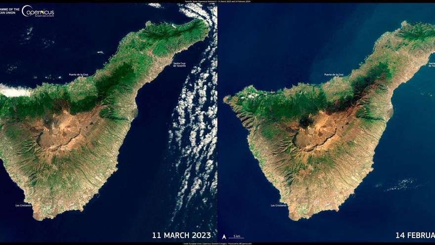
The EU’s Earth observation satellite system, Copernicus, has released a series of images on Monday, 4th March, confirming a decline in vegetation in Tenerife, the island where a water emergency has been declared and which suffered one of its most destructive wildfires last August.
The composition compares an image from 11th March 2023 and another from 14th February 2024, showing a brown area from the August wildfire and a decline in green tones, particularly in the Anaga region, La Laguna, and the southeast part of the island.
In the text accompanying the images, Copernicus refers to the “severe water crisis” facing the island, leading to the emergency declaration during one of the driest winters in recorded history.
“The government is taking proactive measures to ensure a constant water supply, vital for both the citizens and agriculture, especially given that reservoir levels are significantly lower than last year,” they report.
In this aspect, the EU programme has echoed plans to increase water treatment and desalination capacity to alleviate the crisis, along with public awareness campaigns to emphasize responsible water usage.
The Copernicus Emergency Management Service’s European Drought Observatory enables precise monitoring of drought conditions, providing key data for informed decision-making and efficient resource management.


