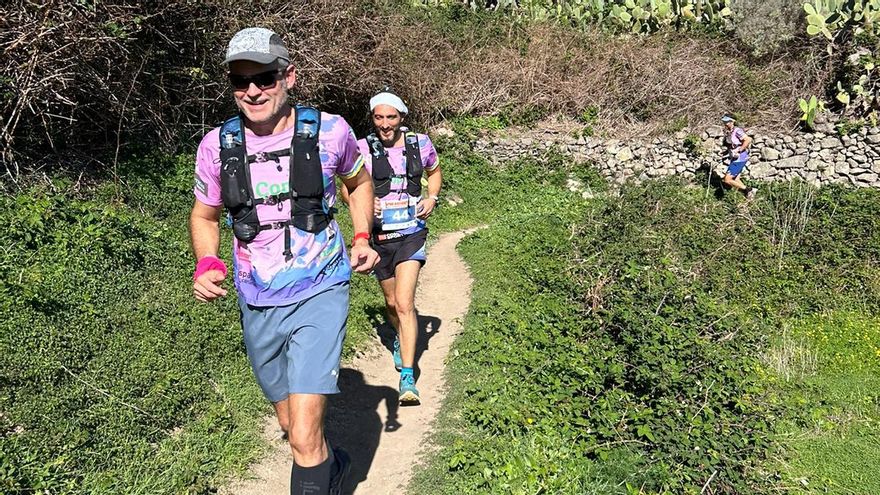
The Anaga Trail Solidaria, where mountain running lovers came together on December 30 in a solidarity initiative that has been repeated for eleven years. All participants spontaneously donated a toy to be given to the most disadvantaged children and in turn the total registration money will be given to the non-profit organization Abrazos y Sonrisas. The toys that were collected will be managed by the San Gerardo Association.
A sporting event under the auspices of the Santa Cruz Sostenible Foundation together with the Sports area of the Santa Cruz de Tenerife City Council and with the collaboration of the Festivities area, which is maintained with the same spirit with which everyone’s solidarity was created. the participants with the most disadvantaged and especially children.
More than a race, as it was not competitive, it was a day where all the mountain runners celebrated their peculiar end of the year, their San Silvestre mountaineer, they took the opportunity to greet each other and enjoy a unique environment such as the Anaga Rural Park, transporting participants respect for the natural environment. This year more than 400 participants did not miss this already obligatory event of solidarity and sport, managing to cover the maximum number of participants established for environmental and safety reasons. There were many volunteers who collaborated in the race.
Route
The start and finish were in the area of the Tenerife Maritime Sports Center (CIDEMAT), next to the capital’s neighborhood of Valleseco, and consisted of a 16 km route, 1011 meters of positive slope and 1016 meters of negative slope, with a average upward slope of 11.5% and downward slope of 11.9%, although at some points both values could reach 50%. The highest authorities attended the start to encourage and thank the runners for their solidarity action. The maximum time to complete the tour was 4 hours.
After the departure, the route ran along Anaga Avenue towards the city center, a road that was abandoned near the Real Club Náutico, later joining José Martí Avenue. Next, it continued on the asphalt along the Carretera or Camino Real de Tahodio. At kilometer 4.7 (141 meters of altitude) the access to the Camino de Valle Luis was reached, a spectacular path that runs in continuous ascent between old terraces, cliffs and waterfalls, and leads to the 666 meters of altitude of the Gollada de la Fortaleza (kilometer 7.63). After a brief respite until the Casas de los Berros, close to the homonymous gallery, the ascent continued to 852 meters of altitude that was reached at the Cuatro Caminos crossing, the highest point of the race, already at kilometer 9, 1. From this place the descent began, initially more intense, to the surroundings of the town of Catalanes (683 meters of altitude in four Caminos, kilometer 9.8), and more progressive from La Fortaleza, where the route begins. It joined the PR-TF 2 trail, which runs through the Valleseco ravine, and was not abandoned until the beginning of the track, at kilometer 14 (141 meters of altitude). The last 2 kilometers continued comfortably on the asphalt, until reaching the finish line.


