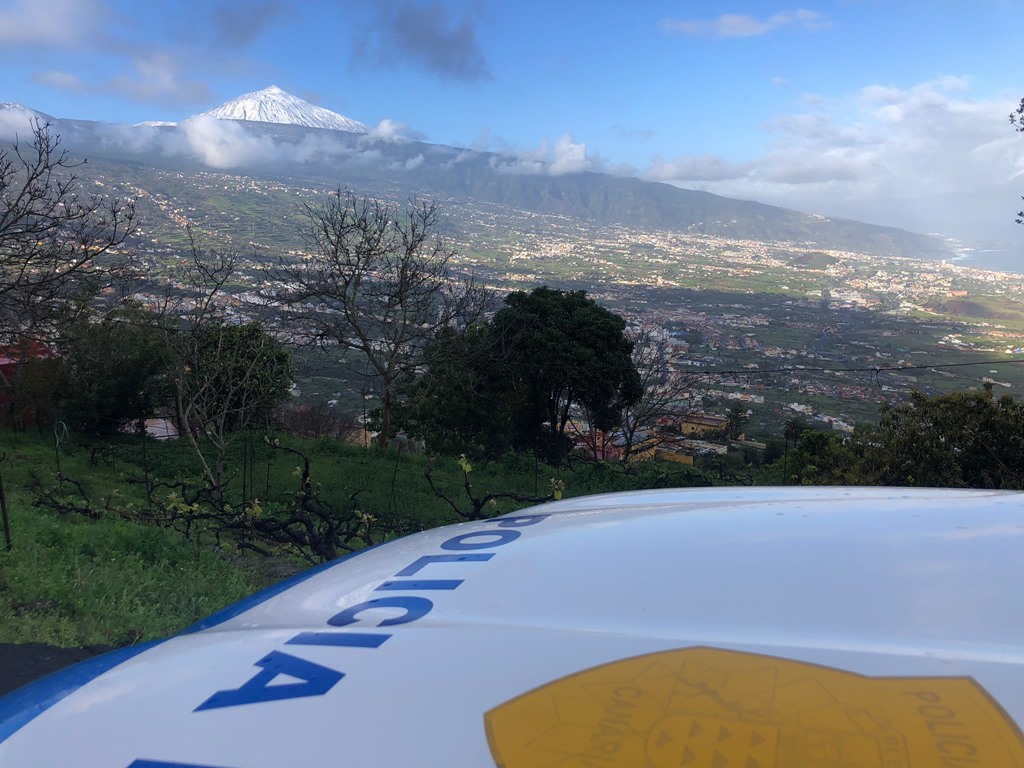
The Security Area of the City Council of La Orotava (CECOPAL) has reopened this Wednesday the access to Teide by La Orotava (TF-21). The Cabildo de Tenerife, for its part, proceeded to reopen access to Mount Teide via the TF-523 road (Arafo crossing), which was closed yesterday due to the presence of water, snow and ice on the road.
📢 Open to traffic access to the #TEIDE by the TF-21 #LaOrotava.
Real-time information on the state of island roads ⬇️https://t.co/Yt0pMiKWrW pic.twitter.com/SjOnIgk2jx
— La Orotava Security Area (@CECOPAL_Orotava) March 16, 2022
Today, the only access to Teide that is still closed is via the La Esperanza highway (TF-24) from kilometer point 24 to 43 due to the presence of ice sheets on the road. The rest of the accesses were opened this Tuesday.
For its part, the Cabildo de La Palma has opened the LP-4 Roque de Los Muchachos road for access from Hoya Grande, Garafía, to the Observatory residence.
However, access through Santa Cruz de La Palma, to Pico de la Nieve, continues to be cut off due to the existence of ice sheets on the road.
The low temperatures recorded these days in the Archipelago, caused by the passage of the stormy celiahave left frost on the peaks of the islands of TenerifeLa Palma and even Gran Canaria, where the access roads were closed due to the presence of sleet on the road.
The snow on Teide It has left a completely white landscape, and many wonder when they will be able to enjoy the national park with all the security guarantees after the storm.
For now, the most curious must make do with the photographs shared on social networks, since the clouds and clearings that predominate this Wednesday on the Island allow the snow on Mount Teide to be captured.
CAUTION IN THE ACCESS TO TEIDE
The General Directorate of Security and Emergencies of the Government of the Canary Islands, based on the prediction of AEMET and other available sources, as well as in application of the Canary Islands Specific Emergency Plan for Risks of Adverse Meteorological Phenomena (PEFMA) has updated the situation by which the entire archipelago is placed on pre-alert for coastal phenomena.
In any case, the Government of the Canary Islands has reported in a statement that a combined sea from the northwest is still expected, with waves that could be between 4 and 5 meters high.
The possible influx of visitors to the National Park requires extreme precautions when visiting it.
SEAS RISK
A dozen autonomous communities will have this Wednesday notices of important risk (orange) or risk (yellow) due to coastal phenomena, wind or precipitation, according to the State Meteorological Agency (AEMET) that foresees that the haze caused by the dust in suspension will continue affecting much of Spain.
Specifically, the important risk due to coastal phenomena, with waves of 5 to 6 meters, will be activated for La Coruña, while Lanzarote, Fuerteventura and Gran Canaria are on yellow notice for this phenomenon, as well as on the coasts of the rest of Galicia, Asturias, Cantabria, the Basque Country, Catalonia, the Balearic Islands, the Valencian Community and Murcia.
On the other hand, the AEMET has activated the warning for rains, which can accumulate up to 80 liters per square meter in 12 hours in Albacete, Malaga, Alicante and Castellón.
In general, this Wednesday the AEMET expects locally strong or persistent rainfall in the southern half of the peninsular Mediterranean area and strong wind in Galicia, Levante, the Balearic Islands and the Canary Islands.
The weather will continue to be conditioned by the presence of the Celia Atlantic storm, predictably located in the south of the Peninsula, which will give rise to abundant cloudiness throughout Spain and unevenly distributed rainfall.
The most abundant will occur in the southeastern peninsular third and may become locally strong or persistent in the southern half of the peninsular Mediterranean area.
In the rest of the country, rainfall will be less likely and weaker and more scattered, and it is not expected in the south of the Canary Islands. In addition, a new Atlantic front will enter the peninsular northwest, so the cloudiness will increase there, with rainfall that will extend from Galicia to the Bay of Biscay, the upper Ebro and the western half of the Pyrenees.
In the Peninsula and the Balearic Islands the haze will continue and the precipitations may be accompanied by mud. Precipitation will be in the form of snow in the mountains of the southeast, from 2,000 meters down to 1,600 meters and in the western Cantabrian mountain range, from 1,400 meters although the level will drop to 1,000 meters. Snow is also expected on Teide.
As for the temperatures, this Wednesday they will drop again except in the southwest of the peninsula, where they will tend to rise. The drop can be locally notable in Galicia, western Cantabrian and southeastern interior. The minimums will drop in the eastern half of the peninsula and will rise in the western third. In the Canary Islands, the thermometers will experience a slight rise.
Finally, regarding the wind, the AEMET expects it to blow moderately and from the west in the Strait and from the northeast in general in the rest of the country, with strong intervals on the Galician coast, the Levante coast, the Balearic Islands and the Canary Islands.


