
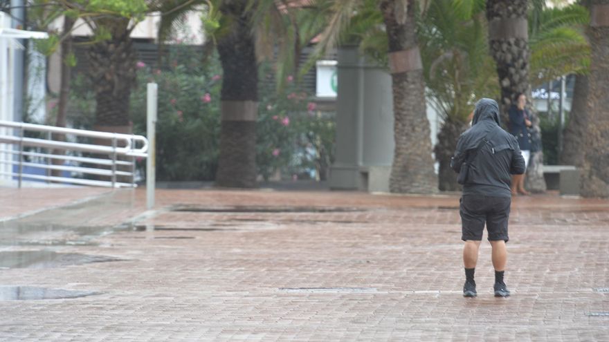
The storm that at the beginning of the weekend was located to the northwest of the Islands Canary Islands left the first rains yesterday, with a maximum of 34 liters per square meter in Valverde, in El Hierro, and will arrive today in the Archipelago with strong gusts of wind and rainfall that may be locally strongespecially on the southwestern slopes of the western islands, Tenerife and La Palma, from the second half of the day. For the first days of this Constitution bridge, the State Meteorological Agency (Aemet) has activated the orange warning for wind, rain and coastal phenomena from 12:00 a.m. to 11:00 p.m. on these two islands, on whose summits gusts of up to 90 kilometers per hour could be reached. In turn, the yellow notice has been declared in Gran Canaria due to wind from 8:00 p.m. in the afternoon, and the yellow warning due to wind and rain from the same time on El Hierro and La Gomera. They will stay tomorrow.
The Aemet prediction has led the General Directorate of Security and Emergencies of the Government of the Canary Islands to declare the wind alert in La Palma and Tenerife starting at 12:00 today. This decision is made taking into account the information available and in application of the Specific Emergency Plan of the Canary Islands for Risks of Adverse Meteorological Phenomena (PEFMA).
The Aemet forecasts that the morning will start with cloudy intervals, with widespread, weak or locally moderate rains, and with a low probability of being heavy on the islands of Lanzarote Y Fuerteventura. Already in the afternoon, cloudy skies are expected on the islands of greater relief with moderate rains, especially on the southwestern slopes, where rainfall could be locally strong. As for temperatures, Aemet forecasts a slight drop in mercury, with highs of 23 degrees in Agaete and Gáldar, 22 in Santa Cruz de Tenerife and 21 degrees in Santa Cruz de La Palma. Minimum temperatures will remain unchanged.
Already for the day tomorrow Monday, The State Meteorological Agency has extended the orange warning on the northwestern slopes of the islands of La Palma and Tenerife, which will be maintained until 11:00 a.m., when it is expected to drop to the yellow level until 2:00 p.m. In the case of Gran Canaria, the declared yellow notice is also extended, which will be deactivated at 06:00, two hours later in La Gomera and from 1:00 p.m. on the island of El Hierro. Lanzarote and Fuerteventura remain without warnings after the light rains on Saturday.
Advisories will be active until noon Monday in the Western Isles
As of Monday morning, the thermometers will begin to notice a slight rise, with a rise in temperature that will reach 25 degrees in the palms of Gran Canaria, and 24 degrees in Telde and La Aldea de San Nicolás in Gran Canaria, as well as 25 degrees in Puerto del Rosario, Fuerteventura, and Santa Cruz de Tenerife, and 22 degrees in Santa Cruz de La Palma.
records
But before the weather improved, during yesterday Saturday, the prelude to the presence of this storm over the archipelago, the clouds watered a good part of the Canary Islands, with light rainfall on practically all the islands. Thus, the El Hierro municipality of Valverde recorded the highest rainfall on the islands, collecting 34 liters per square meter, followed by the town of Agulo, in La Gomera, with 31.8 liters per square meter, and 24.6 in La Victoria. of Acentejo (Tenerife). In Gran Canaria, the highest rainfall was recorded in Tafira, where 14.4 liters per square meter accumulated, followed by Arucas with 13.8 liters per square meter, Teror with 10.2 liters per square meter, and Valleseco, where the rain gauges collected 9.2 liters per square meter.
As for the wind, it blew stronger in the Tenerife town of Izaña, where the Aemet weather stations registered 52 kilometers per hour. It was followed by the speed registered at the La Palma airport, where 37 kilometers per hour were recorded, and the Gran Canaria airport, where the wind blew at a speed of 23 kilometers per hour. On the other hand, Izaña, in Tenerife, also registered the strongest gust of wind in the archipelago, with a record of 58 kilometers per hour.
As for temperatures, despite the drop in thermometers, yesterday was not particularly cold on the islands, where the mercury rose to 26.2 degrees in Vallehermoso, La Gomera, 24.2 in Tuineje , Fuerteventura, and 24 degrees in Playa del Inglés, in Gran Canaria. The minimum temperatures, meanwhile, were recorded in the Gran Canaria municipality of Tejeda, where the thermometers plummeted to 10 degrees, followed by the 12 degrees registered in El TeideTenerife, and El Pinar, on the island of El Hierro.
The Aemet forecasts a slight decrease in mercury for this Sunday’s session
This first day of the effects of the storm on the islands was quite calm and there were hardly any serious incidents or closures of main roads. However, despite the wind that blew on the islands this Saturday, the Canary Islands airports did not have to regret incidents except for three aircraft diversions from Lanzarote to Fuerteventura during the morning due to adverse weather, although all were able to return to their destination during the afternoon, as reported by AENA. On the other hand, the Roque de las Bodegas highway, in Tenerife, suffered rockslides, a mishap that was resolved after a few hours, when normality was restored to facilitate the transit of motorists circulating in the affected area. .
In situations of strong wind, the Government of the Canary Islands makes a series of recommendations to the population to avoid incidents. Among these tips, it stands out to keep informed of the situation and weather forecasts through the different media and to be attentive to the indications of the official channels.
With a wind alert, it is not recommended to leave the house as far as possible and it is recommended to close and secure doors, windows and awnings to avoid drafts that can lead to breaking and falling glass. In addition, it is advisable to check the houses so that there are no cornices, balconies or facades in poor condition that can cause rubble and debris to fall.
In addition, it is advisable to postpone road trips and, if you do, check the state of the roads and take extreme precautions due to the possible presence of obstacles on the roads. The use of public transport is recommended. In the city, it is advisable to stay away from old houses, cornices and walls, and avoid passing by buildings under construction or in poor condition.


