
The DGE (Directorate General of Emergencies) of the Government of the Canary Islands, following the events of the night of Tuesday, 9th of April, will extend the alert declaration due to the risk of coastal flooding to Tenerife, with a particular focus on the eastern and southeastern coast. This was communicated by the Tenerife Council in a weather report from the Insular Directorate of Security and Emergencies.
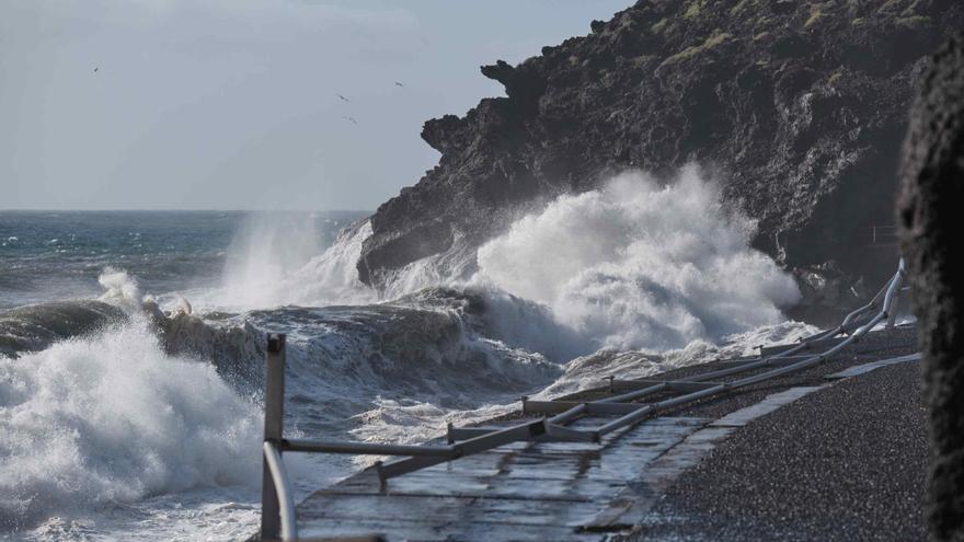
Regarding the events of last night, the Tenerife Council indicates that several “unusual factors” combined to cause incidents with the sea on the southeastern coast of the island, primarily in Güímar, Candelaria, and Arico. According to the report from the insular Corporation, the most significant factor was the “large astronomical tidal coefficient”, associated with the new moon of Monday, the 8th of April. This, coupled with the strong northeasterly wind blowing from sea to coast, wind waves in the strong swell range and swell from the sea following the same direction as the wind at around 2 meters, “resulted in broader than normal seawater entries onto land.”
According to the data from the buoys off Tenerife, the largest waves from Tuesday morning to Wednesday measured between 3 and 3.87 meters; within the values indicated in the current Precautionary Alert. The Council states that the next high tide in Tenerife will occur between 15:05 and 15:40 on Wednesday, 10th of April.
In this vein, “although not to the extent of last night,” the Insular Directorate of Security and Emergencies recommends taking preventive measures along the entire southeastern coast of Tenerife. “Normally, from 1.5 – 2 hours before the peak of high tide and 1 – 1.5 hours after, is when the sea can have the greatest impact on the coast. That is to say, roughly from 13:30 to 16:30, we could experience surges of water and seawater entering the land.”
The wind forecast is similar, it will not decrease in intensity until late afternoon, as per the weather report. The projected wind swell is around 2 meters and the swell from the sea will continue in the same direction as the wind with waves of 1.7 meters. This suggests that most waves will not exceed 2 meters, around 10% of the waves will approach or surpass 3 meters; about 1% of the waves could reach around 4 meters and the highest possible wave could reach 5 meters, “although this value is usually not reached.”
[–>
“The DGE of the Government of the Canary Islands has informed us that, given the events of last night, they will extend the alert status due to the risk of coastal flooding to Tenerife, with particular emphasis on the eastern and southeastern coast.”


")


