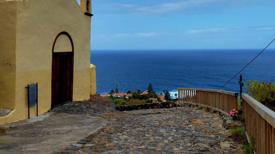
The historian Germán Rodríguez warns of the abandonment and progressive loss of the royal road along the coast, “of a pre-Hispanic layout and used for centuries until late in the 20th century.” With several sections already missing, he claims their recovery and value as a historical vestige that also crosses a landscape of high scenic, agricultural and environmental value.
The royal road along the coast was for centuries the main communication route between the Valley of La Orotava, La Rambla, Daute and Icod de los Vinos. Its layout, probably inherited from the Guanches who inhabited these lands before the conquest, has remained unchanged for centuries when it was the only way to bring people and goods closer on foot or on horseback. Royal historian Germán Rodríguez warns of the abandonment and progressive loss of some sections of this coastal royal road “used for centuries and until well into the 20th century”. This path crosses an environment of great scenic, agricultural, cultural and environmental value and is today a heritage of all as historical as it is forgotten.
Rodriguez points out thatfrom the hermitage of San Pedro to the Barranco de Ruiz a large part of the royal road to the coast is still to be found. With some section missing, it is closed to the passage from El Socorro beach, in Los Realejos ». He adds that it is “a road that connects the northern strip of the island through a landscape of high value. Abandoned and forgotten by the public administrations, awaiting its recovery and enhancement. To their day to day, we must add the possible deterioration that the closure of the Insular Ring can cause to such an ancient communication route and its unique landscape”.
At present, this path has practicable sections between the hermitage of San Pedro and the access road to the Socorro beach, in the Hacienda de las Cuatro Ventanas area. «Before, it continued through the area of the current road and when it reached the top of the beach cliff, it continued through the area of the Socorro hermitage, through the La Torre farm, passing through the Nava and Grimón domains and El Terrero, to the houses of La Rambla de San Antonio. From that point the path picks up again, continues to Barranco Ruiz, crosses it and enters La Rambla or El Rosario, in San Juan de la Rambla. In that last section it is complete, it is passable, although it is narrower, ”says Germán Rodríguez.
This historian recalls that in the 2007-2011 term there was an attempt to recover some of the now closed sections of the Camino Real de la Costa, “but agreements were not reached with all the owners. It was even considered modifying its layout to relocate it on the edges of the farms ».
Between Socorro beach and The Rambla of San Antonio, there are sections closed and others have been lost. “There is a part that disappeared due to a landslide on the coast and, as the entire area has been depopulated, the passage from El Socorro and from the other side was cut off. At the time, they even offered to fence all the sides of the road to protect the farms because the main obstacle was security », he recalls.
Rodriguez explains that “all the royal road is paved. If there are currently parts of land, it is because it has been covered over the years. It also has its cuts of stones that serve as drainage to throw away the water on the sides of the path, as can be easily seen in La Rambla or also in San Pedro». This was the main means of communication for the entire population for centuries. Farm workers, muleteers, landowners, travelers and people who went to work in places that have now disappeared, such as the pier at Punta de El Guindaste, “which was the pier that Los Realejos had to embark all the cane sugar that was produced was carried in carts and put on the boats through davits».
“We are before a historic road that should be rehabilitated. You simply have to clean up deteriorated sections, signpost them and recover what has already been lost. It does not seem like an unaffordable investment in a time when hiking is so popular and, in this case, we are talking about a path linked to history, in a place where sugar cane, malvasia and even the first banana trees have been planted. island. It crosses landscapes and protected spaces, and still allows us to contemplate the haciendas of the great lineages”, says Germán Rodríguez.
Lope Antonio de la Guerra
In his Memoirs, Lope Antonio de la Guerra narrates the journey he undertook to attend a gathering in Nava on the Isla Baja and describes his journey along this royal road in the 18th century.


