
The strong wind scheduled for this Tuesday in the Canary Islands has caused more than 50 incidents without personal injury during the early morning, the majority in the The Gran Canarian palmsas reported by Canary Islands Emergency Coordination Center, Cecoes-112.
These incidents are mostly related to obstacles on the road, landslides, falling tree branches and cornices, but also to problems with power lines.
Most of these difficulties have occurred in the capital of Gran Canaria while also, although to a lesser extent, incidents have occurred in different municipalities of Tenerife, Lanzarote Y Fuerteventura.
The Las Palmas de Gran Canaria firefightersIn fact, they have explained that they are “serving a multitude of services” due to the winds and have influenced self-protection recommendations, which include closing the doors and windows of the houses or removing mobile elements and reviewing the facades.
It is also recommended to avoid unnecessary travel, avoid walking in garden or wooded areas, not walking near construction sites or with elements that could be knocked over by the wind, always notifying 112 in case of perceiving risk situations.
On alert
The alert for calima started at 10 in the morning in all the eastern islandsreducing visibility to less than 1,500 meters. Looking ahead tomorrow, dust concentrations are expected to worsen from today’s 200 to 500 micrograms per cubic meter of air to between 640 and 1240 micrograms. The Yellow notice will extend this day to the entire Archipelagogiving a new twist to the storm that will be accompanied by strong gusts of air.
The wind It was already giving its first blows on Monday, but the alert in the Canary Islands was not activated until this morning at 6:00 a.m. The average speed is between 30 and 60 kilometers per hourAlthough at the peaks it can go up to 70 and 90 km/h, with possible occasional hurricane gusts of more than 120 km/h.

In the case of Lanzarote, the first gusts forced the diversion of three flights before 2:00 p.m.. These planes, headed for the César Manrique airport, came from Great Britain, specifically from Newcastle and Stansted, as well as from Bilbao. However, despite the impact of the haze that caused delays in the arrival of some flights, the Spanish Airports and Air Navigation (Aena) have reported that the deviations have occurred solely because of the wind. Also on this island, the Security and Emergencies Consortium has reported the removal of several billboards and signs that invaded the LZ-408 road when they fell due to the wind. The road, recently resurfaced and improved, connects the town of Nazaret with the Teguise Agrotechnology Center (known as El Complejo).
The storm associated with a DANA has left its greatest havoc to date on the island of Tenerifewhere multiple incidents occurred on the night of Sunday to Monday in the form of blocked roads, flooded houses and even cars trapped in the snow, according to data from the Emergency Coordination Center 112. The greatest rainfall has been taken Cross portwhere the accumulated precipitation has exceeded 60 liters per square meter, becoming the municipality with more rain in all of Spain this Monday. This area is followed adeje Y The victorywith more than 40 liters, and Güímar and Hermigua -in La Gomera-, where more than 30 liters have fallen.
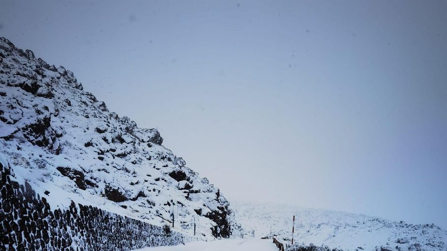
Snow on Mount Teide
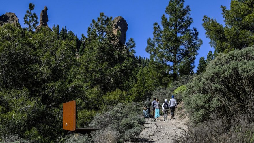
An early morning of intense rain, lightning and hail starred this Monday, December 26, an unusual meteorological day, which divided the two provinces Canary Islands between the polar cold of the western ones and the Saharan heat that dominated the eastern ones. The same day that the first snowfall of winter was announced in the Teidethe island of Gran Canaria woke up with an intense haze and temperatures typical of a day at the beach. An island dispute in the heights, in the midst of a meteorological alert that left a trail of houses and premises flooded, falling branches, more than 600 lightning strikes, hail at low levels and a white blanket that covered the peaks of La Palma and Tenerife.

Many canaries started the day earlier than usual due to the roar of thunder that resounded between mountains or the fall of ice balls. The streets Candelaria and Santa Cruz de Tenerife woke up around 6:30 a.m. with precipitation in the form of hail after a persistent downpour of water. The hail was so abundant that it covered roads very close to sea level with a white and icy blanket, such as those of the Güímar or Tomé Cano Industrial Estate.
It was not the only thing that woke up white. So did the summit of Teide, so that the Cabildo de Tenerife proceeded to close traffic at all accesses to the Teide National Park due to the presence of snow and ice sheets on the road. Thus, on the TF-24, accessed by La Esperanza, the cutoff has been established at Cruce de Los Loros. On the TF-21, through La Orotava, in La Caldera-Aguamansa, and through Vilaflor in the Barranco de Las Lajas. On the TF-38, through Chío, at the height of the Picnic area.
The snow had already covered the previous day El Roque de Los Muchachos, in La Palma, which reached 2.4 degrees below zero. In Tenerife, snowflakes covered the entire volcano and also the surrounding mountains, from Izaña to the Parador, including the Granadilla de Abona and Vilaflor mountain ranges. The snow level dropped beyond the forecast 2,000 meters, allowing the south of Tenerife to enjoy the contrast of that winter picture. It is not surprising, since from early morning and during the rest of the day, the summit remained submerged in temperatures below zero, the lowest being -1.4 degrees registered at the Izaña weather station.


")


