
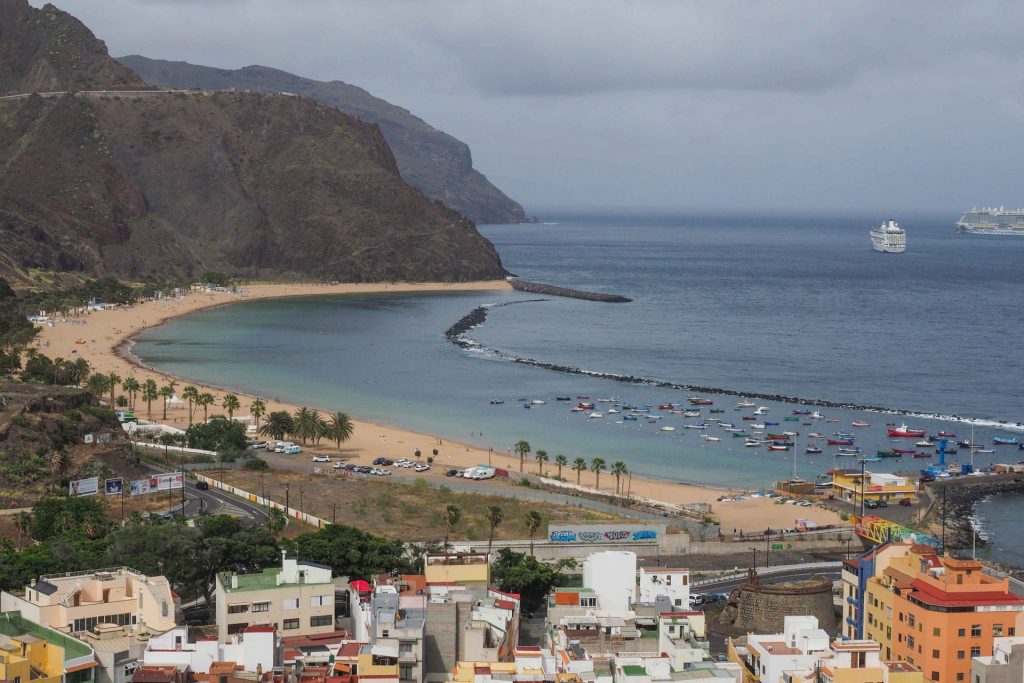
Tenerife, only in 30 years, can experience a rise in sea level in the best scenario (SSP1-1.9) of up to 26 cm, and by the year 2080, the flood will be almost half a meter (40 cm). “The rise in sea level will be especially dangerous in Santa Cruz de Tenerife”, according to the conclusions of the Intergovernmental Group of Experts on Climate Change (IPCC) of the United Nations in the draft of the Sixth Evaluation Report (AR6). Sea level rise every year it will barely be noticeableBut it will keep going up millimeter by millimeter. Santa Cruz de La Palma would be the other Canarian city in serious danger from this rise in sea level.
In 2080, the rise in sea level in Santa Cruz de Tenerife will be the highest in all of Spain, surpassing Barcelona or Cádiz. The palm capital would be the sixth most affected by this dangerous situation.
In just 60 years, several Spanish cities could be “eaten by the sea.” The beaches of Barceloneta, Matalascañas or La Manga could have their days numbered. But they are not the only ones. Over the next 60 years, the more than 8,000 kilometers of coastline that Spain has will be at risk, as they have become one of the main attack flanks of climate change. Sea level rise is now irreversible and, what is worse, unstoppable. At least for several centuries.
Whether it does it more or less quickly will depend on how capable the global population of reduce greenhouse gas emissions, an anthropogenic aspect closely linked to global warming. The five scenarios proposed by the IPCC range from an increase in temperature of 1.5 degrees in the middle of the century to a low emission rate (SSP1-1.9), passing through an intermediate scenario (SSP2-4.5) to reaching more high and – it is expected – less likely with 2.6 degrees (SSP3-7.0).
Acronyms, numbers and data that can get lost between the multiple sheets of a report, but that NASA has rescued to translate them on a map. In it, based on information from the IPCC, it includes 15 points of the Spanish coast that will suffer the rise in sea level.


