
A storm cell impacted on Monday, March 3, in Gran Canaria and Tenerife, resulting in heavy rainfall, hail events, and wind gusts that disrupted normal conditions across numerous regions. This meteorological occurrence, stemming from the interaction of warm, moist air, rapidly intensified, surpassing the initial projections made by the State Meteorology Agency (Aemet).
In the morning of Monday, Aemet issued a yellow warning for rainfall of up to 15 litres per square metre, while the Government of the Canary Islands declared a Pre-alert. However, within minutes, the situation escalated dramatically: the storm intensified, unleashing torrential rain and hail in the northeast of Gran Canaria, prompting the level to be raised to orange and a rain alert to be declared. The municipalities that experienced the most significant impact included Telde, Arucas, Teror, Las Palmas de Gran Canaria, Santa Brígida, and Valsequillo, with Telde bearing the brunt, followed by Arucas and parts of Moya.
Telde, the storm’s epicentre
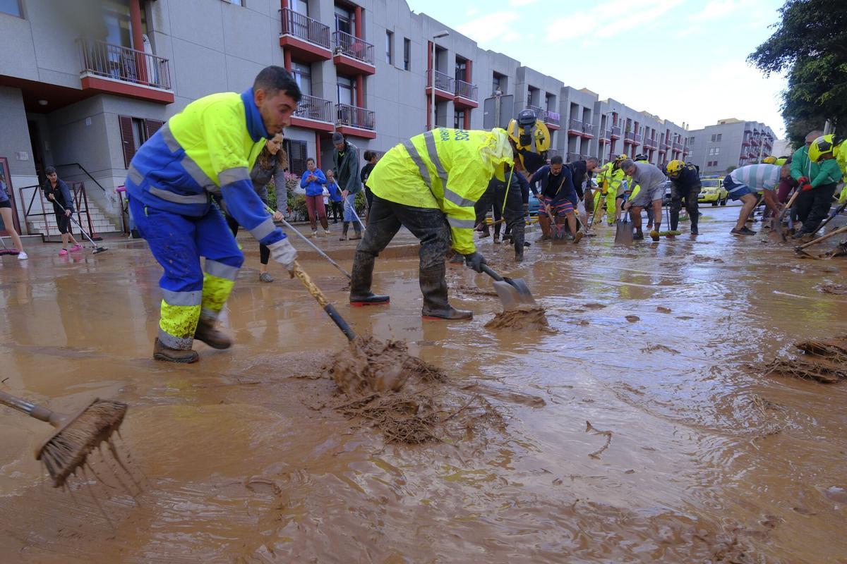
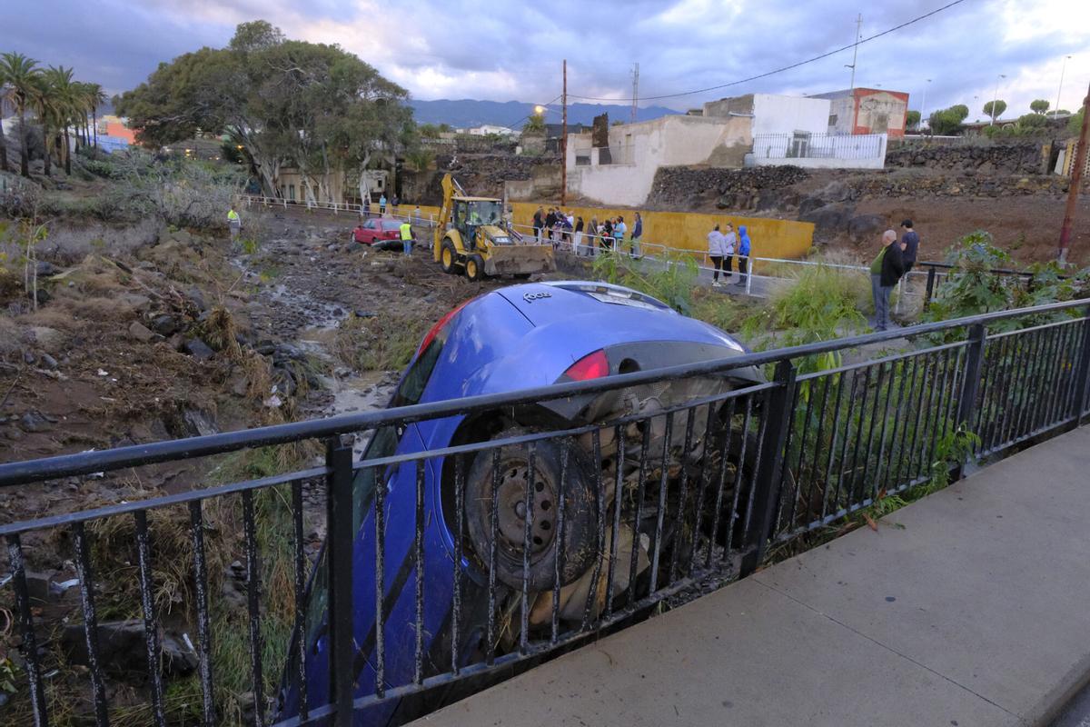
The storm peaked in intensity at 2:00 p.m., although an hour earlier, Telde had already recorded torrential rain and electrical activity. Thunder and lightning heralded a flood that resulted in 257 incidents across various locations, according to the Emergency and Security Coordinating Centre (CECOES) 1-1-2.

Damage caused by the rainfall in Telde / Andrés Cruz / LPR
The greatest challenges were concentrated in the districts of San Francisco Javier and Holiness (Arucas). One of the most critical areas was the Telde ravines, where a lack of maintenance and the accumulation of vehicles exacerbated the effects of rainfall. Water swept away soil, vegetation, and even cars to the coastline in regions such as The Bachelors, Garza, El Caracol, El Barranco de Silva, and the Barranquillo de Salinetas.
What is a storm cell?
A storm cell is the fundamental unit of a storm, characterised by the interaction of ascending and descending air currents. This phenomenon produces intense rainfall, strong winds, and electrical activity. It may occur in isolation or form part of more complex systems such as multicellular storms or supercells, which possess a high destructive potential.
Damage caused by the rainfall in Telde / Andrés Cruz / LPR
The formation process begins when warm and moisture-laden air rises rapidly due to surface heating. As it cools at altitude, water vapour condenses to form cumulonimbus clouds, capable of producing severe storms. During the mature phase, these clouds ascend to great heights and generate heavy rainfall, wind gusts, and electrical discharges. Finally, in the dissipation phase, cold air descends and interrupts the flow of warm air, weakening the storm until it dissipates.
Types of storm cells and associated phenomena
Individual cells are short-lived and typically yield moderate rainfall, while multicellular storms consist of several active cells that can produce heavy rain and high winds. In contrast, supercells are the most hazardous, as they can generate large hail, tornadoes, and devastating winds. Storms originating from these cells may trigger thunderstorms with lightning and thunder, along with torrential rainfall that can lead to sudden floods.
Damage caused by the rainfall in Telde / Andrés Cruz / LPR
Often, hail events occur with varying sizes capable of causing material damage, alongside wind bursts that can exceed 100 km/h, posing a risk of falling trees and structures. The rapid development of these storm systems in the Canary Islands underscores the necessity of closely monitoring weather alerts and taking precautions against extreme events.


")


")
