
Meteorological predictions suggested a carnival spattered with water, and these forecasts have now been substantiated. Beginning this Friday, 28th February, the Canary Islands will experience a phase of atmospheric instability that will extend throughout the coming week, impacting festivities across several islands.
The State Meteorology Agency (AEMET) reports that March will commence with the onset of a Dana (isolated depression at altitude), a weather phenomenon that could lead to heavy rainfall and irregular distribution along with snowfall in the summits of Tenerife and La Palma.
This meteorological body has issued a yellow alert due to anticipated rains in Gran Canaria, Tenerife, La Gomera, El Hierro, and La Palma for this Sunday, 1st March.
The rainfall has already resulted in the first traffic incidents in Gran Canaria on the morning of Friday, 28th February. A mobile home was involved in a road accident on the GC-41, near the San Mateo Fire Department. At the time of the mishap, two employees from the Canarian Emergency Department (SUC), who had just completed their shift, were present in the vicinity and provided assistance to the affected individuals until emergency services arrived.

Image of the incident / The Province
The team from the San Mateo Fire Department promptly responded to the incident to manage the emergency and assess the condition of the damaged vehicle. The precise causes of the accident remain undetermined, although it is believed that weather conditions may have played a role.
Weather forecast for the upcoming days
- Friday, 28th February: Overcast skies with moderate rainfall in the northern regions of the larger islands. Expect strong waves and high wind gusts in Tenerife and La Gomera.
- Saturday, 29th February: Light to moderate rainfall, more prevalent in the north and interior areas of the mountainous islands. Potential for heavy showers in the afternoon.
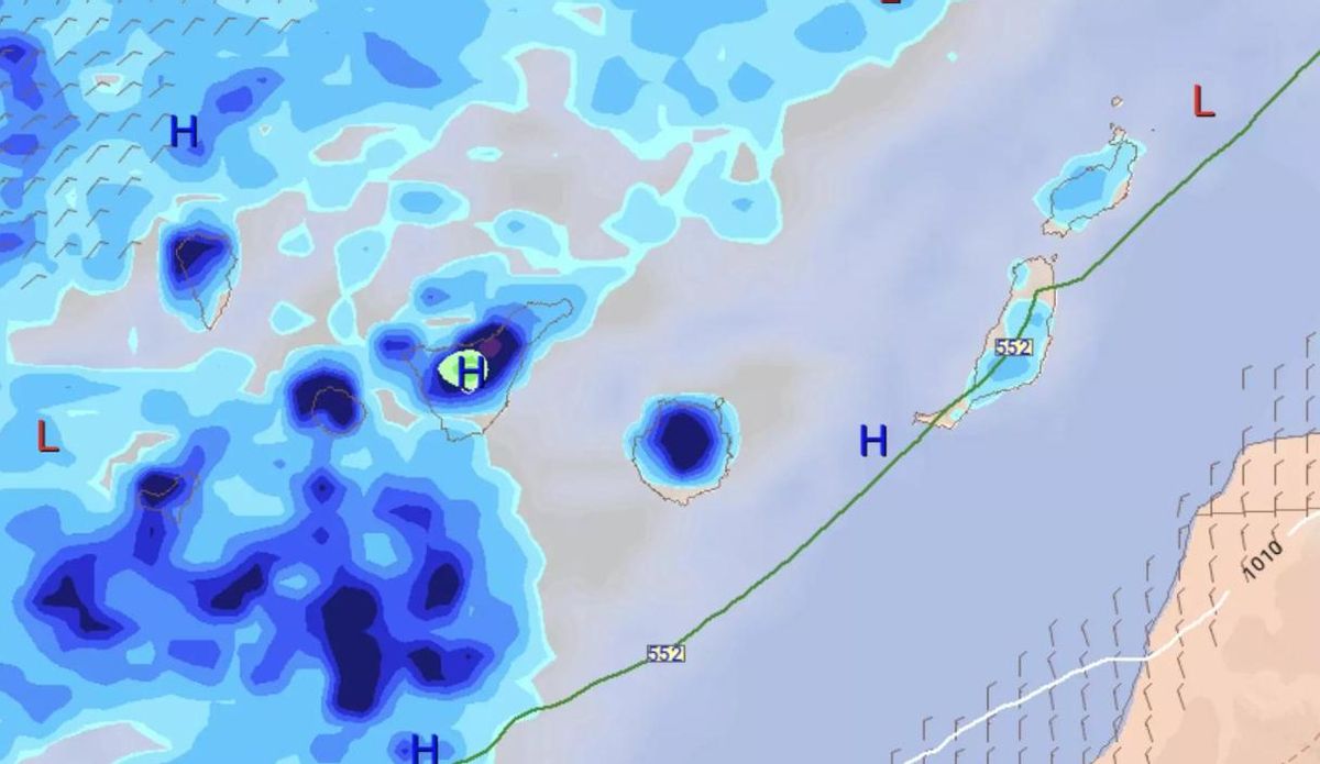
Meteorological forecast for this Sunday / Meteored
- Sunday, 1st March: Increased likelihood of heavy rains and snowfall at elevations above 2,200 meters. A significant drop in temperatures is also forecasted.
- Monday, 2nd March: Continued showers in various regions, with accumulations that could exceed 50 l/m² in parts of Tenerife, La Palma, and Gran Canaria.
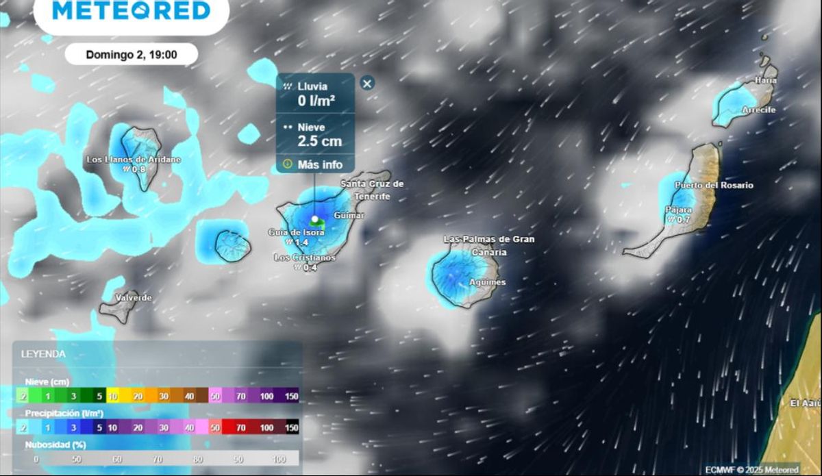
The most significant accumulations are expected in Tenerife and Gran Canaria / Meteored
Potential water and snow accumulations
Meteorological models suggest that instability may result in substantial rainfall records, especially in Tenerife, La Palma, and Gran Canaria, where over 40 to 50 l/m² is anticipated in certain areas. Furthermore, snow accumulation is likely to persist on the Teide and Palmeras peaks.
The winds are expected to diminish in intensity starting Sunday, but there will still be episodes of intense and irregular showers that may produce significant accumulations in specific regions of the archipelago.
AEMET Warnings in effect
Currently, a PREALERT FOR STRONG WINDS is active, along with yellow warnings in Tenerife and La Gomera, which may be extended in the forthcoming hours.
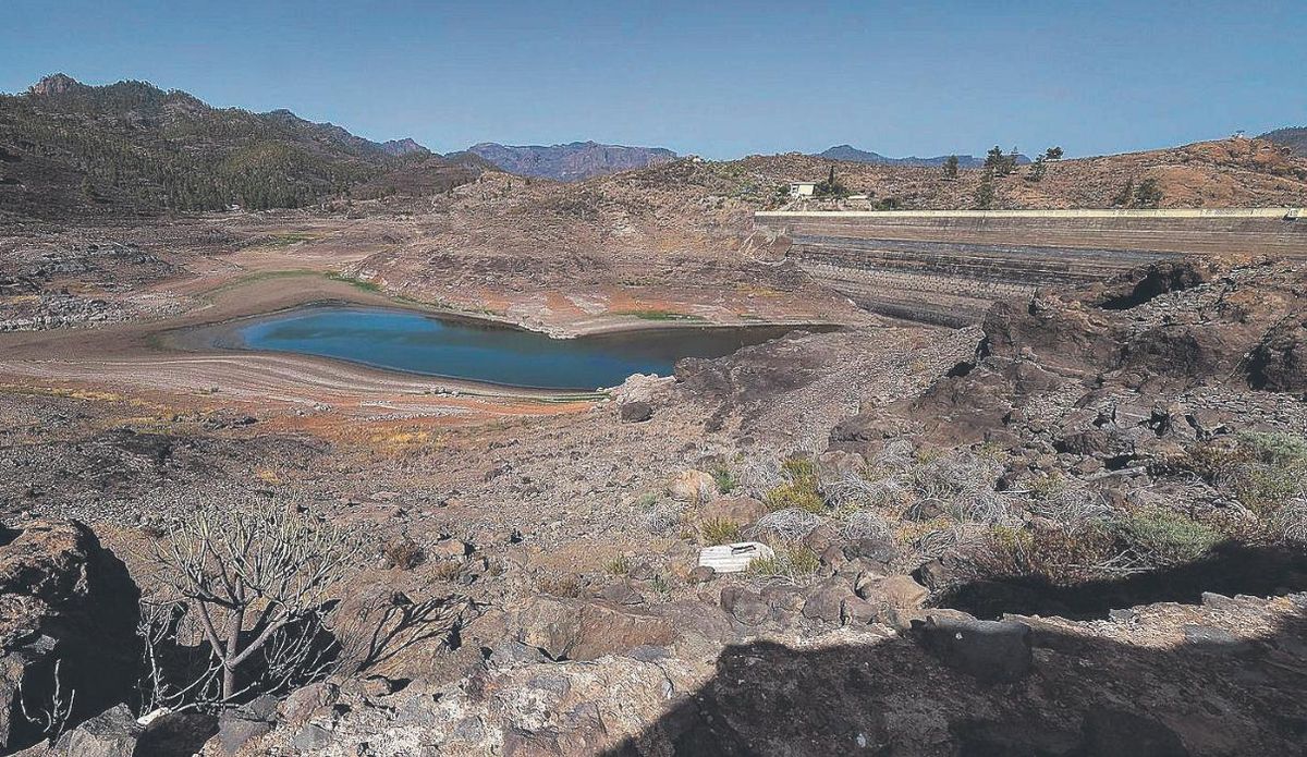
Almost empty dam from last summer / Photo: Andrés Cruz


. By Julio Torres Santos")


