
The southern and western parts of the Archipelago have witnessed a sudden rise in temperatures in the first heatwave of the summer. Thermometers have reached up to 37 degrees in some inland areas of Gran Canaria, such as San Bartolomé de Tirajana, and over 30 degrees in east-facing areas like the city of Santa Cruz de Tenerife. However, while high temperatures are prompting some islanders to bring out their short sleeves and flip-flops, in the north, many citizens have yet to pack away their sweaters. The northern part of the islands, shielded by the “donkey belly” fog formed by the strong clash of the trade winds against the mountains, has remained unaffected by the arrival of summer, with temperatures up to ten degrees lower than on the southern slope, fog, and even drizzle in some areas.
“There has been a significant contrast between the north and south”, warns the Aemet delegate in Canarias, David Suárez. The data confirms these significant differences that, on some islands, have even reached 10 to 15 degrees. Thus, the 37.3 degrees recorded at the Las Tirajanas station, in the interior of Gran Canaria, contrast with the mere 23 degrees in the city of Las Palmas de Gran Canaria. The same has happened on the island of Tenerife, where in the mere ten kilometers that separate Santa Cruz from La Laguna, the temperature difference has been almost 10 degrees: 31.4 in Santa Cruz and 21.9 at the North Tenerife airport.
“The north flow of the trade winds has collapsed at 500 meters, bringing significant cloudiness to the northern slope and even fog,” explains Suárez. In fact, fog has been one of the major obstacles for the smooth operation of the Tenerife airport, as in the early hours of the morning, visibility at the North Tenerife airport barely reached 300 meters.
Some airlines were forced to cancel their early morning flights, while others diverted them to South Tenerife. Binter Canarias, for example, reported on their social media having to cancel up to 14 flights affecting connections between Tenerife and Fuerteventura, La Palma, Gran Canaria, and La Gomera. By the afternoon, with better visibility – up to 1,500 meters – flight delays dominated the flight screen at the La Laguna airport. Most flights departed much later than scheduled, both to the Peninsula and inter-island, when they were not redirected to the Reina Sofía airport in South Tenerife.
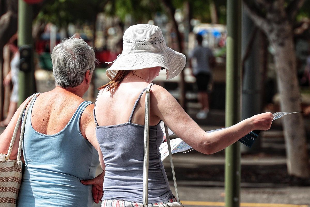
Two women stroll under the scorching sun of Santa Cruz. / María Pisaca
On the other side of the meteorological coin, the warm air mass that has arrived from the African continent to the Canaries, bringing heat and haze, has flown over the southern slope and the inland areas of the Islands. “The entrance of this air mass, combined with high radiation due to the lack of clouds, has caused a significant rise in temperatures,” reveals Suárez. Besides San Bartolomé de Tirajana, among the highest temperatures have been in Agüímes with 33.9 degrees and in La Aldea de San Nicolás with 33.5 degrees.
In Tenerife, the highest temperatures have been in the east, specifically in the metropolitan area. The weather station in Santa Cruz reached 31.4 degrees, making it the highest temperature on the island. This was followed by the summit, with 31 degrees in Las Cañadas and 29.1 degrees in Izaña. Both high-altitude stations (over 2,100 meters high), despite usually recording colder temperatures, suffered the impact of the Saharan air mass that entered the upper layers of the atmosphere, hitting the Tenerife summit head-on. In fact, the arrival of heat also caused nighttime lows not to drop below 15 degrees when it is customary to fall to 12 degrees or even below 10 degrees.
Heat until Monday
[–>
Although the thermometers began to rise on Wednesday, Thursday has shown a more suffocating side. And it is not ruled out that, looking ahead to Friday, the heat may intensify in some areas. The State Meteorological Agency maintains, in this sense, the yellow warning for high temperatures.
The temperatures in Tenerife and Gran Canaria will remain high until next Saturday. However, according to Suárez, the heat is expected to start dissipating from Monday onwards.
The rest of the islands also maintain a yellow warning, but in this case for strong winds and rough sea conditions. The trade winds not only act as a shield against the heat for the northern part of the Islands, their constant and strong flow also causes gusts that can reach speeds of up to 80 kilometres per hour in the southeast and northwest slopes, especially in the El Paso area (La Palma) and inland Lanzarote.
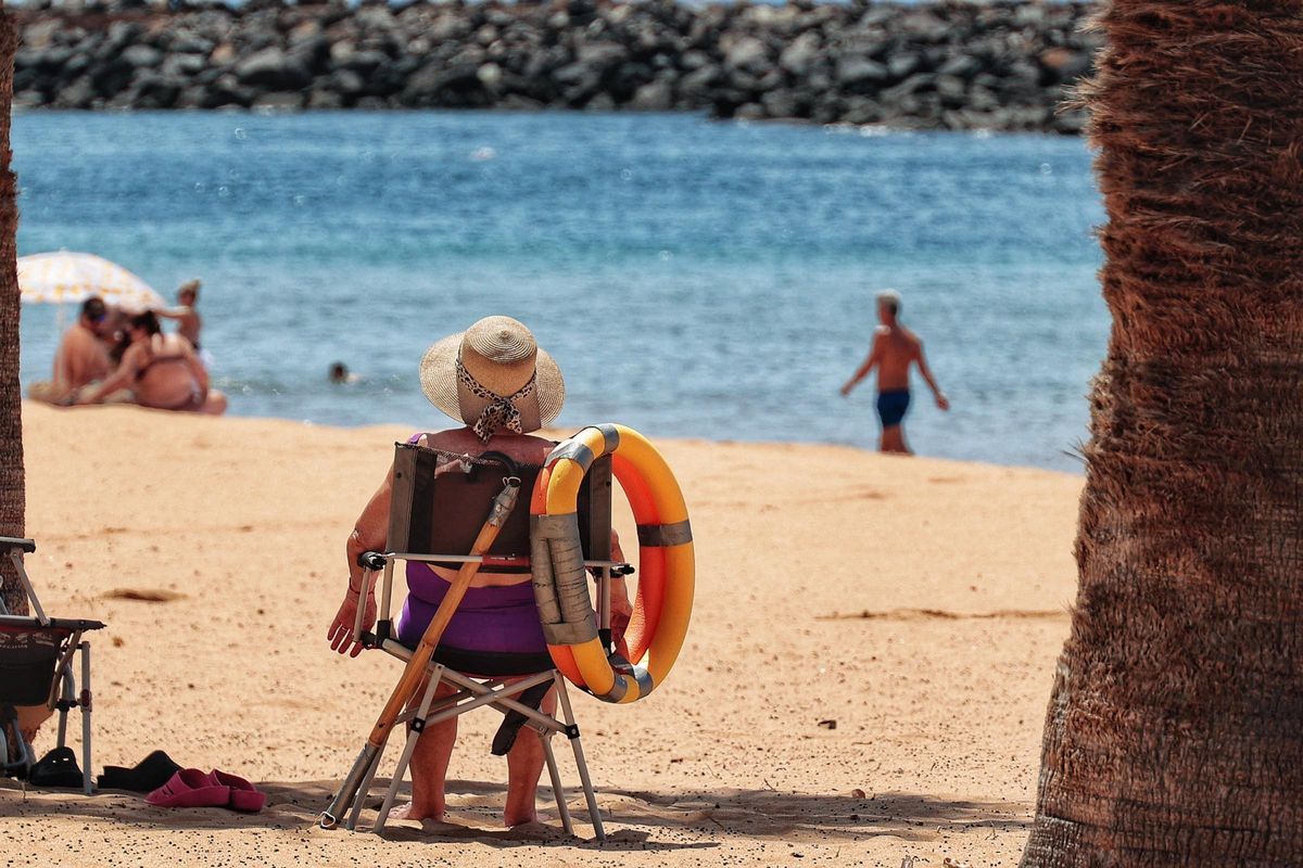
A lady seeks shelter from the heat on Teresitas beach in Santa Cruz de Tenerife. / María Pisaca
The trade winds will continue to blow strongly on Saturday, but as explained by the Aemet delegate, it is expected that by next Tuesday the high-pressure system will start to move slightly towards the west, although it will not dissipate completely yet.
“The high-pressure system has been almost stationary over the Azores for nearly two months,” Suárez recalls. This has caused June to be a cold and humid month with more cloud cover than usual, but the situation is closer to changing. “Towards the second half of July, it seems that there will be a change in the atmospheric dynamics that will push the high-pressure system towards Africa,” Suárez reveals.
This potential shift in wind direction will have consequences for the Canary Islands, which could experience, from then on, greater intrusions of Saharan air and high-altitude dust.
Risk of wildfires
In light of this situation, the Government of the Canary Islands has issued a wildfire alert for the western islands and Gran Canaria. To address the alert situation, the Tenerife Island Council has activated the Territorial Emergency Plan (PEIN), which involves implementing level 1 measures for the prevention of forest fires.
As a result, lighting fires from 7:00 hours today and until further notice in recreational and outdoor areas, such as barbecues, bonfires, stoves or gas cookers, is prohibited. The use of any machinery or tools that can generate sparks (brush cutters, welding equipment or cutting grinders) and the use of any pyrotechnic materials in high-risk areas is also banned. Additionally, smoking is prohibited in recreational areas, camping zones, campgrounds, roads, viewpoints and public infrastructure.
The decision is made considering the adverse weather conditions – the combination of heat and wind can be lethal for forested areas – and the declaration of a high-temperature and wind alert and forest fire risk by the General Directorate of Emergencies of the Government of the Canary Islands on the island of Tenerife.
Rosa Dávila, president of the Island Corporation, issued a plea to the population “to follow the authorities’ instructions and avoid any activities that could cause a wildfire.” “90% of fires are caused by carelessness and are things that can be prevented,” the Tenerife official reminded.
Given the significant rise in temperatures in the summits, it is recommended “not to enter or remain in the island’s forested areas while the alert situation is active, as well as to take extreme precautions throughout the island with any activities that could cause fires.” The restrictions corresponding to level 1 of forest fire prevention will remain in effect until the alert situation ends.
Efforts are being maximised this summer to prevent a repeat of the forest fire from the previous summer that devastated the Forest Crown of Tenerife. The damages in the island’s mountains are still evident, and there are even trails that remain closed after the incident that started on August 15 and affected the north and south of Tenerife.


")


")