
The State Meteorological Agency (AEMET) has declared an orange alert for Lanzarote, La Gomera, and the summits and southern areas of Gran Canaria due to strong winds, with a yellow warning for the rest of the islands. Extreme caution is advised at sea due to adverse coastal phenomena.
This alert situation will start on Tuesday, 9th April, at midnight, with maximum gusts of 90 kilometres per hour mainly affecting the southeast slopes of Gran Canaria, interior south areas of Lanzarote, and the summits of La Gomera and Gran Canaria.
The rest of the areas will also not escape the wrath of the god Aeolus, as AEMET predicts maximum gusts of 80 km/h, especially affecting regularly exposed areas. Additionally, occasional gusts reaching 90 km/h are possible in the El Paso area, Punta de Teno, high summits of Tenerife, and the extreme northwest of Gran Canaria.
ISLAND FORECAST FOR MONDAY:
LANZAROTE
Partly cloudy skies, clearing towards the end of the day. Temperatures with little change. Moderate north winds, becoming stronger during midday in elevated interior areas.
EXPECTED MINIMUM AND MAXIMUM TEMPERATURES ( °C): Arrecife 17 24
FUERTEVENTURA
Partly cloudy skies, clearing towards the end of the day. Temperatures with little change. Moderate north winds with strong intervals. Very strong gusts are possible on the leeward side of the Jandía peninsula around midday.
EXPECTED MINIMUM AND MAXIMUM TEMPERATURES ( °C): Puerto del Rosario 17 23
GRAN CANARIA
Cloudy skies in the northern slopes with low chances of scattered light rain. In other areas, partly cloudy or clear skies. Slight temperature decrease. Moderate north winds intensifying progressively throughout the day. Intense gusts are likely in wind-exposed areas, especially in mid-altitudes and summits.
EXPECTED MINIMUM AND MAXIMUM TEMPERATURES ( °C): Las Palmas de Gran Canaria 18 23
TENERIFE
During the first half of the day, cloudy skies in the north slope with occasional light rain. By the afternoon, clear skies will develop in the north, while increased cloudiness is expected in the southeast slope with possible light, scattered, and occasional precipitation. In other areas, partly cloudy or clear skies. Temperatures with little change. Moderate north winds intensifying in the afternoon with very strong gusts likely in high areas of Valle de Güímar, low coastal areas in the southeast, and the Teno Massif. In the Central Massif, intervals of strong winds with low chances of very strong gusts. Breezes on the southern coast.
EXPECTED MINIMUM AND MAXIMUM TEMPERATURES ( °C): Santa Cruz de Tenerife 18 24
LA GOMERA
Cloudy skies on the northern slope with low chances of occasional light rain. In other parts, partly cloudy or clear skies. Temperatures with little change. Moderate north winds turning northeast in the afternoon, with stronger intervals on the east slope and sheltered mid-altitudes, where very strong gusts are possible.
EXPECTED MINIMUM AND MAXIMUM TEMPERATURES ( °C): San Sebastián de La Gomera 18 23
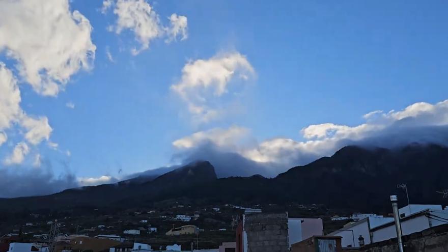
LA PALMA
Predominantly partly cloudy skies in the northern and eastern slopes with low chances of scattered light rain. In other areas, partly cloudy or clear skies. Temperatures with little change. Moderate north winds with occasional light intervals, turning northeast in the afternoon and increasing as moderate east winds in the El Paso area. Stronger winds in the southern tip by the afternoon. Breezes on the west coast.
EXPECTED MINIMUM AND MAXIMUM TEMPERATURES ( °C): Santa Cruz de La Palma 16 22
EL HIERRO
Partly cloudy skies on the north slope. In other areas, partly cloudy or clear skies. Temperatures with little change. Moderate northeast winds, intensifying in the southeast extremity. Stronger winds in the summits by the afternoon, with likely very strong gusts also in mid-altitudes of the southeast slope.
EXPECTED MINIMUM AND MAXIMUM TEMPERATURES ( °C): Valverde 16 18


")


