
Wednesday, 20th March, will be dominated by strong winds in Canary Islands. Additionally, it will be a day with partly cloudy or clear skies, low chance of rain in the north of the mountainous islands, and decreasing temperatures in inland areas, as reported by the State Meteorological Agency (Aemet).
Regarding the wind, it is expected to be moderate with strong intervals from the north and possibly very strong gusts locally.
The very strong gusts are expected mainly in the early and late hours of the day, on the southeast and west slopes of the mountainous islands, and from the afternoon onwards in the summits, especially in Gran Canaria, Tenerife, La Gomera, and El Hierro.
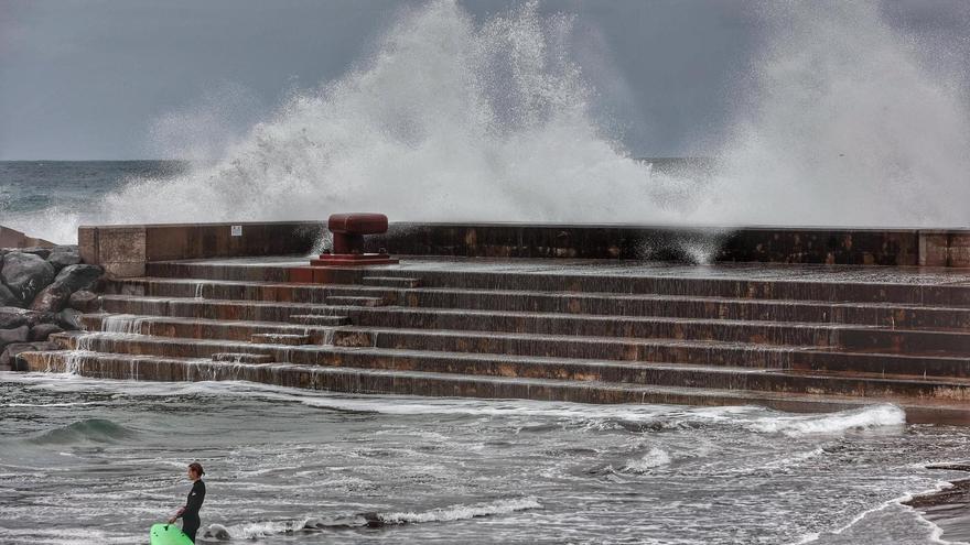
As for sea conditions, expect north or northeast winds of force 4 or 5, locally 6 or 7, rough or very rough seas, and varying from force 1 to 3 and 2 to 4 on the west, southwest, and south coasts with slight swells. There will be northwesterly swell with waves of 1 to 2 meters.
[–>The island-wise forecast is as follows:
GRAN CANARIA
[–>
In the north, cloudy intervals with predominantly cloudy skies in the early and late hours and low chance of occasional light rain in the early morning and from mid-afternoon, especially in mid-altitude areas. In other areas, partly cloudy with some high clouds. Temperatures with little change on the coasts and slight decrease in inland areas, which may be locally moderate in the maximum temperatures on the southern slope. Moderately strong north to northeast winds, with strong intervals and the possibility of very strong gusts locally on the western and southeastern slopes, especially in the early morning and especially in the late hours when the wind will intensify, and could also occur on the summits.
Forecasted minimum and maximum temperatures (°C): Las Palmas de Gran Canaria 17 22
Cloudy intervals, not ruling out occasional light drizzle in the north and west during the central hours. Temperatures slightly decreasing in inland areas and with little change on the coasts. Moderately strong north winds, with strong intervals and not ruling out very strong gusts at specific times in the south in the late hours.
Forecasted minimum and maximum temperatures (°C): Arrecife 16 23
Cloudy intervals. Temperatures with little change on the coasts and generally slightly decreasing inland. Moderately strong north to northeast winds, with strong intervals and no ruling out very strong gusts at specific times on the west side and in the south of Jandía in the late hours.
[–>Forecasted minimum and maximum temperatures (°C): Puerto del Rosario 17 23
TENERIFE
[–>
In the north, cloudy intervals with clearing in the afternoon and low chance of occasional light rain in the northeast, especially in mid-altitude areas, during central hours and at the end of the day. In other areas, generally partly cloudy with some high clouds and some convective clouds in the southwest during the afternoon. Temperatures slightly to moderately decreasing in inland areas, especially the minimums, and with little change on the coasts. Moderately strong north to northeast winds, with strong intervals and the likelihood of very strong gusts locally in the far northwest and east, primarily in the early and late hours of the day, as well as on the southern face of the metropolitan area in the afternoon when the wind will intensify, and strong gusts could also occur in central summits.
Forecasted minimum and maximum temperatures (°C): Santa Cruz de Tenerife 17 23
LA GOMERA
[–>
In the north, cloudy intervals with clearing in the afternoon and low chance of occasional light rain in central hours and at the end of the day, mainly in mid-altitude areas. In the rest
Weather Forecast for the Canary Islands
In the northern and eastern areas, there will be partly cloudy skies with some sunny intervals in the afternoon and a low probability of light and occasional rain in the central hours and late in the day, especially in the midlands of the north. In other areas, it will be mostly clear with some high clouds at times. Temperatures will slightly to moderately decrease in inland areas, mainly the minimum temperatures, and remain relatively stable along the coasts. There will be a moderate northeasterly wind, with occasional strong gusts and a low probability of very strong gusts locally on mountain tops and in the northwest and southeast extremities, especially in the late hours.
Expected minimum and maximum temperatures (°C): San Sebastián de La Gomera 17 23
On the island of El Hierro, in the north, there will be partly cloudy skies with significant breaks of sunshine in the afternoon, and the possibility of light and occasional rain in the central hours and towards the end of the day, especially in the northeastern midlands. In other areas, it will be mostly clear with some high clouds at times. Temperatures will remain unchanged, with slight decreases in inland areas, especially in the minimum temperatures. A moderate northeasterly wind is expected, with occasional strong gusts and a possibility of very strong gusts locally on the southwestern and southeastern slopes, as well as on mountain tops, in the early hours and particularly in the late hours.
Expected minimum and maximum temperatures (°C): Valverde 13 19


")


