
The National Geographic Institute (IGN) has placed 18 underwater sensors between Tenerife, Gran Canaria and Fuerteventura to detect underwater earthquakes. This significant initiative is part of a research project undertaken by the IGN, aiming to uncover the origins of seismic activities occurring between Tenerife and Gran Canaria.
Thirteen devices will be stationed in the waters separating Tenerife and Gran Canaria, with an additional three set between Fuerteventura and Gran Canaria. These seismic sensors, similar to their counterparts on land, have been designed to withstand the pressure at depths of up to 3,000 meters. According to Itahiza Domínguez, the IGN director and lead project personnel, these sensors will gather data for six months before being retrieved between June and July. It is anticipated that conclusive results will be available by year end.
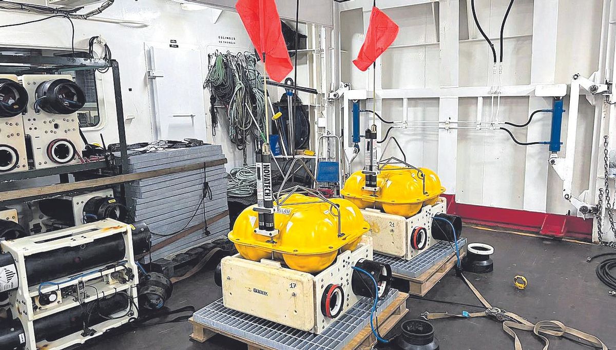
The sensors are specially encapsulated to endure depths of 3,000 meters. / La Provincia
The Director of IGN pointed out that the data collection process has its peculiarities, as other sounds such as those of whales can infiltrate the recordings, hence the need for special handling of this data.
Investigating the root cause of the frequent earthquakes in the area
Every year, the area records between 200 and 400 earthquakes of varying magnitude. This continuous seismic activity has resulted in some of the most intense earthquakes remembered by the local population, the earthquake in 1989 being a striking example, which was felt by many in Santa Cruz de Tenerife and some parts of Gran Canaria.
As Canarias lies in the centre of the African tectonic plate, it was early on ruled out that these incessant tremors could be caused by the collision of tectonic plate boundaries. One of the prevailing theories has been that the earthquakes are triggered by an active volcano known as the Enmedio volcano.
However, researchers are not entirely convinced and do not consider it the most likely cause. Despite the fact that “almost all significant seismic activity occurs before or during volcanic eruptions in the Canaries, this area does not conform to this pattern,” as explained by Domínguez. This is because the inter-island activity occurs annually without any apparent volcanic activity. The Enmedio volcano, though present, may not necessarily be the source of the earthquakes.
These devices will remain submerged for six months to collect data
“Our theory is that the origin is tectonic, related to a structure merging with the crust,” emphasized Domínguez, not ruling out the possibility of a fault in the area. “It could be shallow or very deep,” stressed the researcher, highlighting that the Canarian crust is located 10 kilometres below the surface. “This study will aid us in understanding what lies beneath,” he added. In addition to earthquake recordings, this project also aims to conduct a subsurface tomography to comprehend the distribution of seismic activity.
The IGN is already exploring options to expand this project across the entire archipelago. “We aim to gain a better understanding of the entire structure of the Canaries,” highlighted Domínguez. There are still uncertainties surrounding the formation of the archipelago, with the prevailing theory being that of the hot plume, however, this hypothesis presents certain challenges that a better understanding of the underwater structure may help resolve.


")


