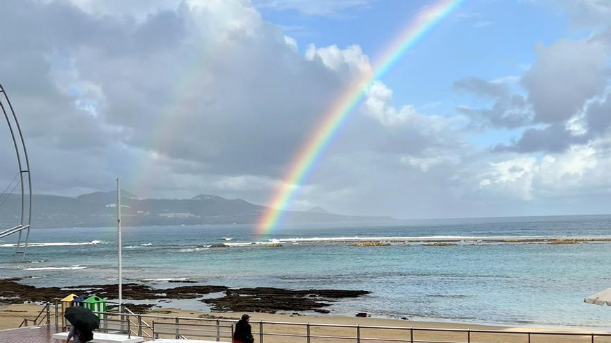
Cloudy with light rains in the north of the most mountainous islands, opening wide clearings at midday. Clouds and clearings in the rest of the areas, with greater cloudiness and some light rain in the south of the most mountainous islands during the central hours of the day.
Temperatures will experience few changes and the wind will blow from the moderate northeast, with some strong intervals on the southeast and northwest slopes of the most mountainous islands.
In the sea there will be 3 or 4 northeast, 4 or 5 offshore in the northwest and southeast. Marejadilla, or swell in the northwest and southeast. In the northeast near the coast, northeast 2 or 3, temporally variable 1 to 3. Ripple or swell and northwest swell of 1 to 2 meters.
PREDICTION BY ISLANDS FOR THIS SATURDAY:
LANZAROTE
Cloudy intervals, more compact in the north in the late hours, when there is a low probability of some weak and occasional precipitation. Minimum temperatures without changes and maximum temperatures in slight decrease. Moderate northeast wind.
FORECAST MINIMUM AND MAXIMUM TEMPERATURES (°C):
Reef 21 28
FUERTEVENTURA
Cloudy intervals. Temperatures with few changes, with a slight decrease in maximum temperatures on the western slope. Moderate northeast wind.
FORECAST MINIMUM AND MAXIMUM TEMPERATURES (°C):
Puerto del Rosario 21 28
GRAN CANARIA
In the north, cloudy intervals, with predominance of cloudy skies and probability of weak and occasional rain in the early morning, especially in the midlands. In the rest, little cloudy, except for intervals on the southern slope. Temperatures with few changes, with slight increases in minimum temperatures in interior areas. Moderate wind from the northeast, with strong intervals in the afternoon on the southeast slope and extreme west.
FORECAST MINIMUM AND MAXIMUM TEMPERATURES (°C):
The Gran Canarian palms 23 27
TENERIFE
Cloudy intervals, with a predominance of cloudy skies and a probability of weak and occasional rain in the north and northeast during the first half of the day, and in the interior southwest in the afternoon. Temperatures with few changes, except for slight decreases in maximum temperatures on summits. Moderate wind from the northeast, with strong intervals during the second half of the day on the eastern slope and extreme northwest. In central summits, light wind from the north.
FORECAST MINIMUM AND MAXIMUM TEMPERATURES (°C):
Santa Cruz de Tenerife 23 28
LA GOMERA
Cloudy intervals in general, with a predominance of cloudy skies and a probability of weak and occasional rain in the north during the first half of the day and, with less probability, in the southwest interior in the afternoon. Minimum temperatures in slight rise and maximum temperatures with few changes. Moderate wind from the northeast, with some strong intervals during the second half of the day in the extreme east.
FORECAST MINIMUM AND MAXIMUM TEMPERATURES (°C):
San Sebastian de La Gomera 24 28
THE PALM
Cloudy intervals, with predominance of cloudy skies in the northeast during the early morning. Chance of weak and occasional rain, especially in the northeast and east during the first half of the day, and in the interior southwest in the afternoon. Temperatures with few changes. Moderate wind from the northeast, with some strong intervals during the second half of the day in the extreme southeast and northwest.
FORECAST MINIMUM AND MAXIMUM TEMPERATURES (°C):
Santa Cruz de La Palma 22 26
THE IRON
Cloudy intervals in general, with a predominance of cloudy skies in the north during the early morning. Chance of light and occasional rain, mainly in the north during the first half of the day and, with less probability, in the southwest interior in the afternoon. Temperatures without changes or slightly rising. Moderate northeast wind.
FORECAST MINIMUM AND MAXIMUM TEMPERATURES (°C):
Valverde 18 22


