
Cloudy intervals with clear opening during central hours in western Lanzarote and Fuerteventura, and north of the islands of greater reliefaccording to the forecast of the Meteorology Statal Agency (Aemet) for this Saturday in Canary Islands.
In the rest of the areas, slightly cloudy or clear skies with some morning intervals on the southern and western coasts of Tenerife.
Temperatures unchanged or slightly loweringmore pronounced in the values of the minima in interior areas of the mountainous islands.
Moderate north component windmore intense on the eastern and western slopes of the higher relief islands, where some interval of strong wind is expected, as well as in areas to the south of Lanzarote and Fuerteventura.
In the high peaks of Tenerife, from the strong northwest, with probability of locally very strong gusts at dawnabating to moderate from noon, and finally decreasing to weak at night.
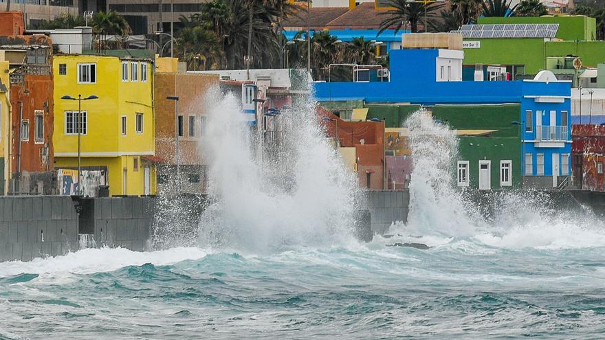
In the sea there will be a north or northeast component, force 5 or 6, increasing to 7 offshore on the west and southeast coasts. Strong swell increasing locally to thick offshore on southeast coasts. On the north coast, the northern component forces 3 or 4 and storm surge or strong storm surge. On the south coast, variable 1 to 4, breezes, swell or swell.
Weather forecast by islands for this Saturday in the Canary Islands:
LANZAROTE
In the north and west, cloudy intervals, with clear openings during the afternoon and a predominance of cloudy skies in the late hours. In the rest, little cloudy or clear in general. Little changed temperatures. Moderate north component wind with some strong interval to the south.
FORECAST MINIMUM AND MAXIMUM TEMPERATURES (°C):
Reef 22 29
Fuerteventura
Slightly cloudy or clear in general, with cloudy intervals on the west slope during the morning and late hours. Temperatures with few changes in general or with some slight decrease. Moderate northwest wind with some strong interval in inland areas and south of jandia.
FORECAST MINIMUM AND MAXIMUM TEMPERATURES (°C):
Port of Rosario 22 28

Predominance of cloudy skies in the north, with the opening of large clearings in central hours. Slightly cloudy or clear in the rest of the areas. Temperatures in slight decrease, without changes in the midlands and northern coasts. The decrease could be locally moderate in the southern midlands. Wind from a moderate north component, more intense on the east and west slopes, where some strong wind intervals are expected and a low probability of a locally very strong gust.
FORECAST MINIMUM AND MAXIMUM TEMPERATURES (°C):
The Gran Canarian palms 22 26
TENERIFE
Cloudy intervals on the northern slope, more compact in the early hours, with the opening of large clearings during the afternoon. In the rest of the areas, little cloudy or clear, except for some morning intervals on the south and west coasts. Minimum temperatures in slight decrease, more pronounced in high areas. Highs unchanged or in slight decline, more pronounced on the southeastern slope. Wind from a moderate north component, more intense in the extreme northwest and northeast, where some intervals of strong wind are expected, with a low probability of a locally very strong gust in the extreme northwest and south of the metropolitan area. In high peaks, from the strong northwest, with the probability of locally very strong gusts at dawn, easing to moderate during the morning, and finally decreasing to weak at night.
FORECAST MINIMUM AND MAXIMUM TEMPERATURES (°C):
Santa Cruz de Tenerife 23 29
Little cloudy in general, with intervals in the north during the morning and at night. Slightly dropping temperatures. Wind from a moderate north component, more intense on the east and west slopes, where some strong wind intervals are expected and a low probability of a locally very strong gust.
FORECAST MINIMUM AND MAXIMUM TEMPERATURES (°C):
San Sebastian de la Gomera 23 27
Cloudy intervals in the north and northeast, with clear openings during the afternoon. In the rest of the areas, little cloudy. Temperatures in slight decrease in general, more pronounced in the values of the minimum, which in inland areas could be locally moderate. Highs with few changes on the eastern shores. Wind from a moderate north component, more intense on the northwest and east slopes, where some intervals of strong wind are expected.
FORECAST MINIMUM AND MAXIMUM TEMPERATURES (°C):
Santa Cruz de la Palma 22 27
Little cloudy in general, with intervals in the north. Slightly dropping temperatures. Wind from a moderate north component, more intense on the east and west slopes, where some interval of strong wind is expected.
FORECAST MINIMUM AND MAXIMUM TEMPERATURES (°C):
Valverde 18 20


