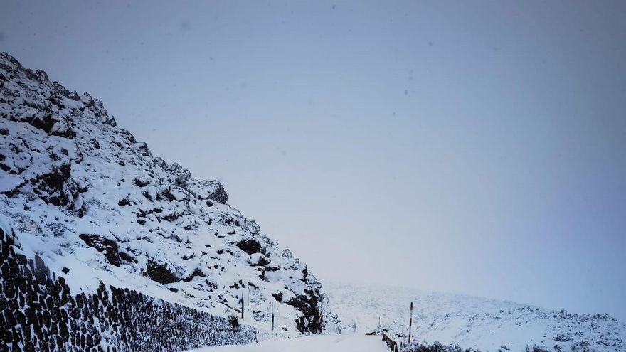
The spokesman for the State Meteorological Agency (AEMET)Ruben del Campohas affirmed this Wednesday that Canary Islands you will be outside the ‘Fein’ storm that shakes the Peninsula although you will be able to see some snow on the peaks of Tenerife and La Palma since it could snow in the archipelago above 2,000 meters.
Also the winds will blow strong this week and they will drag clouds that will leave rain in the north of the most mountainous islands and the temperatures, except in the summits, will not vary much.
The storm has its most intense day of adverse phenomena this Wednesday but as of this Thursday it will reduce its intensitysince a rise in temperatures of up to 8 degrees Celsius (8ºC) is expected, the frost will reduce its extent and the snowfall will appear at higher levels, after this Wednesday snow may fall almost at sea level.
hurricane force winds
Rubén del Campo has indicated that This Tuesday ‘Fein’ left winds with hurricane gusts, of more than 120 kilometers per hour in mountain and coastal areas. For example, in Machichaco (Vizcaya) they reached 166 kilometers per hour and in Valdezcaray (La Rioja) a gust of 154 kilometers per hour was recorded.
In addition, significant amounts of precipitation accumulated in the northern third, since from 9:00 a.m. on January 17 to 9:00 a.m. on January 18 (rainfall day) more than 70 liters per square meter were collected at points in Asturias and the country Basque.
Also this Wednesday the arrival of the arctic air mass is already noticeable which has caused a temperature drop, because during the early hours of Wednesday it has even dropped to -10ºC in the Pyrenees. Del Campo highlights the -12ºC registered in Portainé (Lérida) and Cerler (Huesca) and the snow level has dropped significantly, to the point that it has snowed in cities in flat areas such as Ávila, León, Segovia, Burgos, Pamplona or Victory.
The spokesman expects that the adverse situation due to the arctic air mass driven by the Fien squall will continue on Wednesday and warns of significant snowfall this Wednesday at low levels in the northern half: in the northern third it will snow from about 300 or 400 meters and They will accumulate between 5 and 15 centimeters of snow.
Specific, the eastern Cantabrian, Navarra and the mountain areas will be the areas in which the greatest accumulations of snow are expected. In addition, they will accumulate more than 20 centimeters of snow from 1,000 meters in mountain areas of the northern half.
Likewise, Del Campo expects that it will snow in “wide areas” of the northern plateau, in the surroundings of the Central system and in the mountains of Eastern Andalusia and they will not be ruled out in flat areas of the eastern half of the peninsula, where the level will drop in the last hours of the day up to 400 meters and even at sea level in the Bay of Biscay, while in the Balearic Islands there can be precipitation in the form of snow from 600 meters.
At the same time, the spokesman explains that this “panorama” will be accompanied by gusts of wind that will continue to blow strongly in the Mediterranean area and in the Balearic Islands and, in fact, in the south of Tarragona and north of Castellón they may exceed 100 kilometers per hour. The wind will cause a maritime storm with waves up to eight meters high in the Bay of Biscay and four meters in the Mediterranean.
In general, there will be a general decrease in temperatures throughout Spain, which will be “especially” in the northwest, southeast and the Balearic Islands, where the mercury can drop up to eight degrees Celsius compared to Tuesday.
snowfall
The episode of snowfall will continue this Thursday, a day in which the AEMET spokesman predicts that the snow level will rise “clearly” compared to Wednesday and will be above 1,200 meters-1,400 meters from the afternoon in the north.
Nevertheless, in the Pyrenees it will continue to snow at any level and it will also snow in the Central and Iberian System. In the Balearic Islands, for its part, the level will remain at 600 meters.
As a result of the rise in the snow level, the spokesperson expects that the precipitations will be in liquid and abundant form that day in the Cantabrian Sea, especially in previously snowy areas, so thaws are expected so that the beds of some rivers will drop with a lot of water.
In the rest of the country the skies will clear, although there may be cloudy intervals and the strong wind will continue, especially on the coasts of Galicia and the Cantabrian Sea, where they will blow strongly and the maritime storm will continue, with waves up to 5 meters high. . Also in the Mediterranean there will be waves of 2 to 3 meters and the strong north wind will blow in the Ebro valley.
As for temperatures, this Thursday the maximum will rise remarkably, up to 6-8ºC in the northern third of the Peninsula compared to Wednesday, but the minimum will drop inland so that frost will spread over large areas of the Peninsula and the Pyrenees will exceed -10ºC.
The anticyclone returns on the weekend
Looking ahead to Friday, the spokesman points out that abundant rainfall will continue in the Bay of Biscay and it will snow in the Pyrenees above about 600 meters. Weak and scattered rains are also expected in other parts of the northern half and in mountainous areas of the Peninsula, with a snow level located around 1,400 meters, so that thaws will continue to occur because it will continue to rain in areas where it had previously snowed.
On Friday temperatures will continue to rise notably in almost the entire country, especially at night, which can add up to eight degrees Celsius compared to the previous day and frosts will be limited to mountain areas, although in the Pyrenees they will be strong again, with minimums of between -8 and -10ºC at high levels of the Pyrenees.
starting on saturdayonce the AEMET terminates the temporary anticyclonic weather will be established againwith clear skies, although it will still rain in parts of Galicia and not ruled out in other parts of the northern half and in isolation in the Mediterranean and the Balearic Islands, but with less rainfall.
However, Del Campo hopes that as of Saturday the intense cold will continue to be evident during the early morning and early morning hours, which will be marked by slightly cloudy skies, calm skies and cold air, which will remain stagnant over the Peninsula, which will favor an “intense night cooling” so that frost will be widespread in the interior during the weekend.
As of Sunday they will drop to -4 or -5ºC in large areas of the interior, especially on the two plateaus; and -8ºC in the páramos of the center and mountain areas. “They will be forceful frosts, intense frosts, since we are talking about the coldest days of winter, with temperatures that will be between 5 and 10ºC below normal for this time of year,” the spokesman stressed.
Regarding Sunday and Monday, he anticipates that the cold environment will continue in the north, center and east of the Peninsula and that in a large part of the interior of the peninsula the maximum will not exceed 8ºC.


