50% of the urban centers and tourist areas of Tenerife it is inaccessible. This is demonstrated by the average of the data obtained by a study by the council which for three and a half years analyzed the state of pedestrian routes, crossing points, ramps, stairs, toilets and parking lots in the 31 municipalities of the Island. A diagnosis in the form of an innovative map that is presented as a tool to be developed by the administrations public, basically the town halls. A “positive” starting point, according to Queremos Moversos, a group that defends people with disabilities. Its spokesperson, Ana Mengíbar, however, reduces accessibility to 20% of the spaces analyzed.
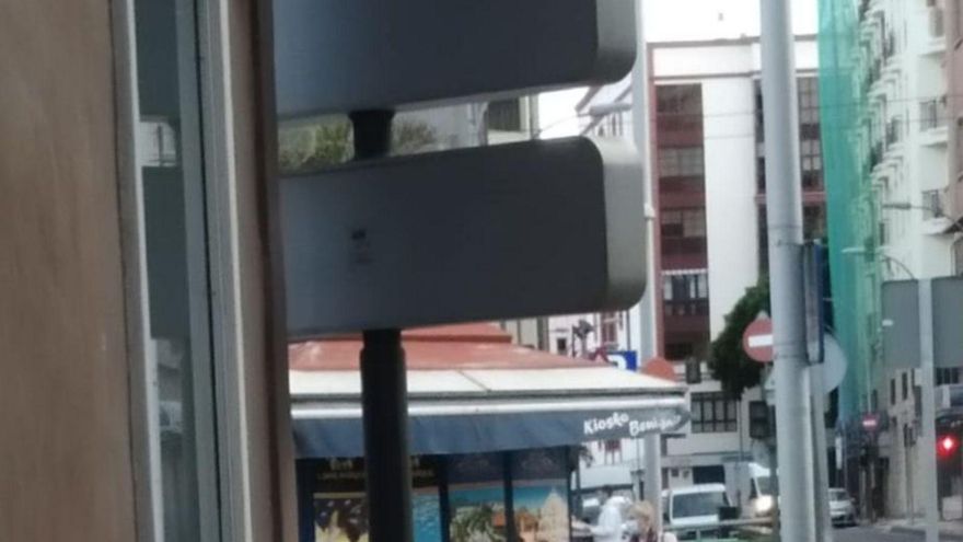
Juan leaves home in his wheelchair to tour one of the main towns on the island. At the beginning, a traffic signal occupies the sidewalk, a little further on a treacherous billboard awaits him and throughout the route he must avoid several curbs . To help Juan and those like him who suffer from some type of disability to know the degree of accessibility of his environment, this map was created. It proposes changes in urban planning such as creating mobility routes for people with any type of disability: physical, sensory or intellectual.
The map lists those obstacles that Juan must overcome on a daily basis. The Island Society for the Promotion of Persons with Disabilities (Sinpromi) studied for this the state of 660 kilometers of pedestrian routes, 10,400 crossing points, 346 ramps, 401 stairs, three elevators, 49 toilets, 19 toilets for ostomies and 1,195 parking spaces. of parking. 21,800 improvement points have been located. These improvement points can be seen geolocated on the Tenerife Accessibility Map located in the Grafcan viewer.
51% of pedestrian routes are accessible, compared to 23% that are not. 29% of the crossing points meet this condition compared to 33%. Up to 36% of public toilets are inaccessible and only 30% respond satisfactorily to the analysis. The town councils are already aware of this diagnosis and have shown interest in tackling solutions to the red (inaccessible) or amber (practicable) points, as well as keeping the green (accessible) ones on the list.
The person in charge of Accessibility at Sinpromi, Dulce Fragoso, assesses: “Accessibility forms a chain in which all the links have to join”.
Some of the elements that make it difficult for people with disabilities to pass and that are repeated the most in the report are construction fences, traffic signs or rubbish bins located on the sidewalk and lampposts that cause the narrowing of the passage. In addition to improving the life of the citizens with any type of disability or with mobility difficulties, a figure that can reach 40% of the population, the tool is linked to good tourist use as one of the five key axes of a smart destination,
The areas of Modernization and Social Action chaired by the councilors Berta Pérez and Marián Franquet, respectively, collaborated in preparing the map.
Pérez explains that it is an important instrument that “will help public administrations promote projects that result in improved accessibility and will allow Tenerife to be positioned as an inclusive, responsible, safe and sustainable destination.” He adds that it is born as “something alive to be permanently updated so that the information is useful.” He highlights the importance of “the involvement of the municipalities, which have direct powers.”
Franquet values the importance of the map “to guarantee equal rights and opportunities and improve the quality of life of those who start from a disadvantaged situation in terms of mobility”. In this context, he emphasizes the added value that new technologies provide to improve accessibility.
The Accessibility Map of Tenerife shows the points where there are deficiencies in this area. And there are still many on the Island.
230,000 Euro
The cost of the commission to Sinpromi, the result of which is the insular accessibility map of Tenerife, amounts to 250,000 euros and the work time, in three phases, to three and a half years.
660 kilometers
The analyzed pedestrian itineraries occupy 660.7 kilometers of the surface, in addition to 10,494 crossing points. The degree of accessibility links both parameters studied.
1,195 car parks
The analysis included the examination of 1,195 parking spaces and other elements susceptible to assessment such as ramps (346), stairs (401), elevators (3) or accessible toilets (49).
21,821 improvement points
The map detected 21,821 points to improve. 20% serious –high security risk–, 22% moderate –they hinder or disorient– and 58% mild –they do not comply but do not hinder–.


