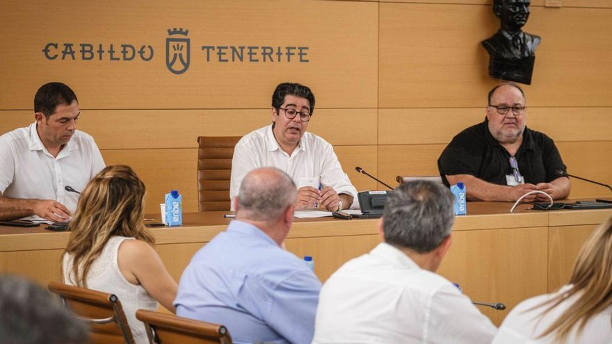
An explanation regarding recent phenomena such as seismic swarms in the Teide National Park and a request for collaboration, cooperation and coordination in the Plan against Volcanic Risks approved in 2020. It is the purpose of the meeting called by the Cabildo with the participation of Involcan to the municipalities of the Island. If alarms but with the beginning of a work planned that will begin with the installation of 18 stations for measuring groundwater parameters in as many municipalities of the 31 in Tenerife.
The Cabildo proposes to reinforce the volcanic surveillance program always in collaboration with local administrations. The island president, Pedro Martín, explains that portable equipment will be provided for taking samples with two objectives: to improve information and reinforce control tasks
Martín explained that the Island Corporation will finance the acquisition of this equipment, which will have an approximate cost of 50,000 euros and the municipalities will be asked to, once the equipment is supplied, “take charge of taking weekly samples and sending them so that they can take into account In the coming months, a more defined plan of how the Island’s activity is developing in this area”.
“We are meeting today with 18 municipalities, ranging from Güímar to La Orotava, to ask for their collaboration”, values the president.
Martín recalls that in the Insular Plan against volcanic risk, approved two years ago, “there is a fundamental element, which is cooperation and coordination between the municipalities and the Cabildo to establish a planning strategy.” The document was approved and homologated in 2020, although it was presented just a year ago. In July 2021 and, Martín underlines, “we have to continue implementing measures to guarantee the security of the Island, within which it is essential to manage information.”
No data for the alarm
The president clarifies that “there is no data that leads us to be alarmed, but we do have to be vigilant.” He adds that these new tools are added to those already permanently existing on the Island, such as the 19 broadband seismic stations, the 8 thermometric monitoring stations and the 11 chemical monitoring stations, all of which were installed several years ago. “In short, it is about continuing to observe different parameters, in this case of the waters, which can provide us with a more exact criterion of what the situation is like,” summarizes Martín.
The Island Action Plan against the Volcanic Risk of Tenerife (PAIV) is the emergency document provided by the Cabildo to provide an adequate response to emergencies of a volcanic nature that occur on the Island. It is a tool that prepares to find out how to act in the event of a volcanic emergency, which includes risk zones, shelter areas in the event of an evacuation or instructions for communicating with the population, among other issues of interest. It is a document promoted by the Technical Security and Civil Protection Service of the island institution, which depends on the Natural Environment and Security area, and developed by the Chair of Disaster Risk Reduction at the University of La Laguna (ULL) .
“This plan implies working very closely with the municipalities, especially those located in the northwest corner of the Island, so this meeting is a sample of that coordination that we maintain,” concluded Martín.


