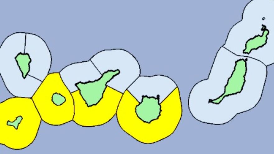
the islands of Gran Canaria, Tenerife, La Gomera and El Hierro They will be on yellow notice from the afternoon of this Friday due to coastal phenomena –strong waves–.
As reported by the State Meteorological Agency (AEMET)the risk will be in force from 3:00 p.m. this Friday and will foreseeably remain throughout the day on Saturday.
Specific, It is expected that there will be a northeasterly wind of force 7 in the southeast of Tenerife, in the Anaga-Agaete Channel, and in the west and southeast of Gran Canaria; being from the north or northeast and force 7 in El Hierro and the west and east of La Gomera.
Meanwhile, in the whole of Spain, temperatures will rise even more this Friday in the north of the Peninsula, which could register its most intense day in this heat wave, especially in the northeast of the peninsula, where they could also rise again on Saturday, a day in which the mercury will begin to descend through the western third of the peninsula.
The AEMET spokesman, Rubén del Campo, explained in statements to Europa Press that this Friday will be the most intense day of the heat wave, along with Saturday, in the Basque Country, Navarra, La Rioja, eastern Castilla y León and Catalonia.
However, on Saturday they will begin to drop and they will notice a thermal relief in Galicia, western Castilla y León, Extremadura and western Andalusia, in front of the Ebro basin, in Aragón and Navarra, where that day they will be able to rise “even a little more” until they reach 42 or 43 degrees centigrade (ºC) in Tudela (Navarra) or Zaragoza.


