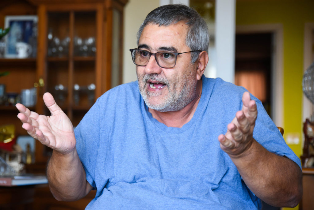
Paulino Martin (Icod de los Vinos, 64 years old) is one of those characters who has a special attachment to the old, it is only enough to be in his house in La Laguna to realize it. To begin with, in the garage he has two classic vehicles from the 1960s, authentic well-cared-for gems. Already in his apartment, any corner breathes history, with transistors with a century of life, old sewing machines, or replicas of old cars or replicas of old sailboats. But above all, Paulino is unique in a love of exhibitions, among other reasons because he does not have enough space to exhibit the more than 300 historical maps of the Canary Islands that it has well classified and stored in a room with its corresponding dehumidifier.
Precisely this fact of not being able to exhibit so much historical richness is what has led Paulino Martín to offer his collection, free of charge, to the institutions or administrations that commit to exhibiting these works, because “to archive them -he says- they remain in my home”. On this issue, the collector recalls that “my lawyer only sets three conditions: that the maps be exposed, that they would be transferred and that in case, let’s give an example, I get diarrhea, my wife and I can have 40 % of the value of the collection”, which he himself puts at “more than 100,000 euros”.
A possibility that has been opened, after the recent visit to the house of Paulino Martín, the head of the La Laguna Archive and a professor of Geography and History at the ULL. “They were shocked by the maps that I have, that they have been looking at one for almost three now, so much so that they even said that there was unknown material on them,” she says proudly. The visitors exposed the collector to the possibility of acquiring the work, without him having to lose ownership, with a condition similar to patronage, in order to exhibit a selection of it. Something that, by the way, he will do next April 25, San Marcos, in his hometown, invited by Antonio Fleitas, president of the Icodense CIT, to reopen the Drago Visitors Center.
“Nieves and I don’t have children and what we would like is for all these maps, all with authenticity stamps, to be exposed so that schoolchildren could learn about their value and part of the history of the Canary Islands, it’s a shame that only you -in reference to DIARIO DE AVISOS- and now those of the Archivo de La Laguna, have been the only people outside of the family and friends who have been able to see it”, he regrets.
The collection of those 300 maps was started by Paulino Martín twenty years ago and he doesn’t know exactly why. “Here one in an antique dealer, then another and then another, until I got into Internet auctions and bought from antique dealers in the Netherlands, Australia, Argentina or the United States.” He does not dare to say which of his maps is more valuable, although he admits that he has paid more than three thousand euros for some of them. The oldest one is dated 1552 and is the work of Sebastián Munster, “when the islands still appeared deformed, but always including the islets of Lanzarote and Fuerteventura, something that was lost over time.” The collection of maps, some of them hand-painted, dates back to the middle of the last century, and among its authors those of the 18th-century naturalist and ethnographer, Sabino Berthelot, also stand out.
All these maps have the coordinates and even tastings for the entry and exit of ships, highlighting those made by the French Navy.
Now retired, Paulino keeps his passion for cartography very active and right now he is behind a map that hangs in the library of the United States Congress in Washington: “An antiquarian offered it to me; it is a chart of the Atlantic Ocean from 1700 by Johannes Loots of which only five units have been put up for sale since 2011”.


