
The island of Tenerife offers a great variety of trails for all tastes with geological characteristics representative of the volcanic origin and diverse flora and fauna, also finding routes of greater or lesser difficulty and duration. Of course, they all share a common factor, and that is that the beauty of each of their landscapes will not go unnoticed. For this reason, we present some of the best hiking trails in Tenerife because admiring the wonders of the different enclaves of this Island is a fantastic way to enjoy a different day.
From Cruz del Carmen to Punta del Hidalgo
Distance: 10.4 km
Duration: 4 hours
Among the best hiking routes in Tenerife we find the path that begins in Cruz del Carmen and ends in Punta del Hidalgo, going through the Green Mount, the town of Carboneras Y Chinamada.
This path has a length of about 10 kilometers, which can be covered in approximately 4 hours and is of medium difficulty. For the descent, it is advisable to wear comfortable and appropriate footwear for walking on sandy and stone-covered terrain. Throughout the tour you can get spectacular photographs of the landscapes that Tenerife encloses, adorned with its impressive cliffs bathed by the Atlantic and its vegetation.
** The interactive route shown is a route proposed by a registered user in the popular Wikiloc application
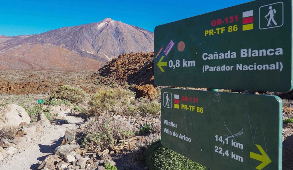
Montaña Blanca trail to Pico del Teide
Distance: 8.3 km
Duration: 5 hours
This trail is divided into three stages, being a fairly complete route and for which good form is required, so it could not be left out of the list of the best hiking routes in Tenerife.
The first part goes from Montaña Blanca to the Altavista Refuge and you can access the start of the tour both by car and by bus. In this area, the landscape of explosive volcanism stands out, where pumice stone predominates in the ground. Later, after having traveled about 4.5 kilometers and passing the peak of Montaña Blanca, a path of young lava flows begins with great unevenness, until reaching the giant rocks known as the Estancia de los Ingleses and, finally, to the Altavista Refuge.
The second stage ranges from Altavista refuge to La Rambleta, where the path does not have such a steep slope and where the badlands of Teide stand out.
The third part starts at La Rambleta and ends at the peak of Teide, going along the Telesforo Bravo path, for which a permit is required, which is highly demanded, although it is free.
Finally, it is time to turn around, being able to walk back or go down by cable car from the peak to the base station on the slopes of Teide.
** The interactive route shown is a route proposed by a registered user in the popular Wikiloc application
The Vilaflor route – Lunar Landscape – Vilaflor
Distance: 12.9 km
Duration: 4-5 hours
To the south of the island of Tenerife we find the Lunar landscape, which can be accessed by starting a walking tour from Vilaflor from Chasna, although there are other alternatives, being able to choose between starting the trail in Granadilla de Abona or in the Parador de las Cañadas del Teide.
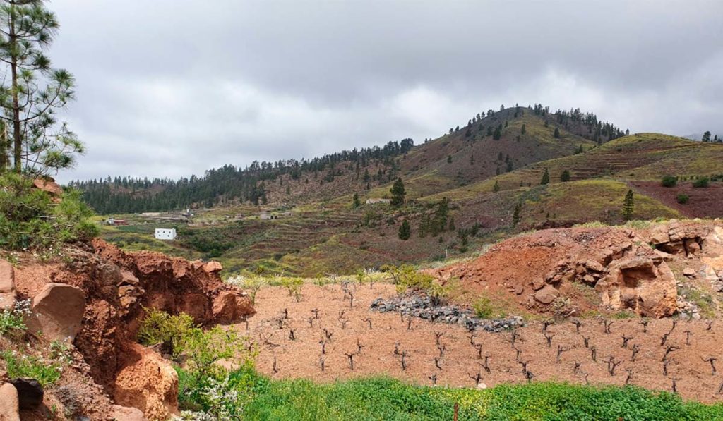
Focusing on the circular path that starts and ends in Vilaflor, highlights the possibility of enjoying the flora of the Corona Forestal del Teide Natural Park. Once we leave the town of Vilaflor de Chasna behind, we will find the Camino del Atajo, which is part of the old Camino Real de Chasna. As you go uphill and through the pine forests, you can see the pretty town from above, with a slight view of the sea in the background. Finally, on the way down, we come across the Lunar Landscape, which makes this route one of the best hiking routes in Tenerife, until we return to the path that leads back to Vilaflor.
** The interactive route shown is a route proposed by a registered user in the popular Wikiloc application
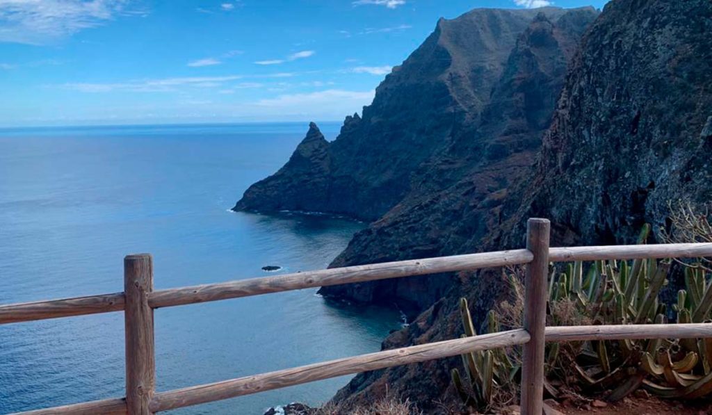
The way Afur – Taganana – Afur
Distance: 14.3 km
Duration: 7 hours
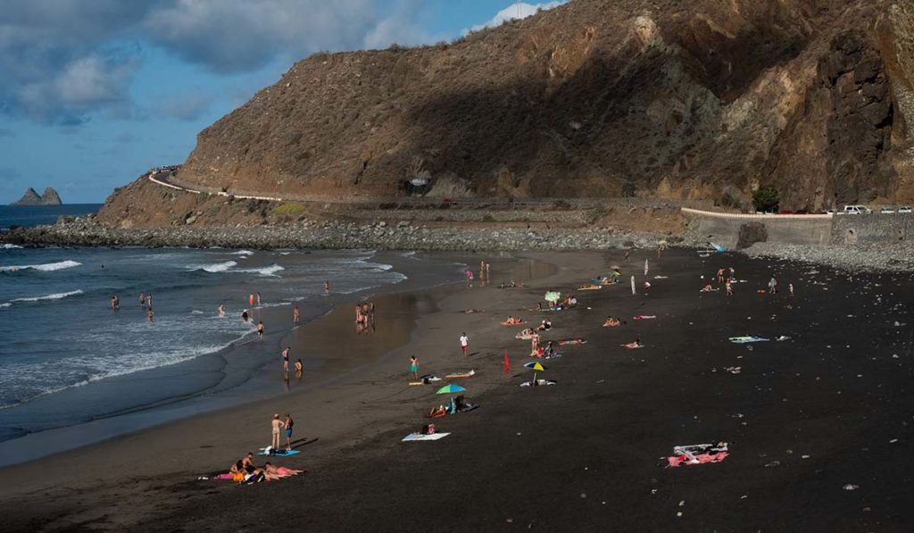
This trail is a circular route that begins in Las Casas de Afur, descends through the ravine, continues near the Tamadite Beach (one of the many wild beaches de Tenerife), surrounds the town of Taganana and ends in Afur.
As a curiosity, the name of Afur comes from a Guanche word that means oven or charcoal. Thus, the path that begins in this area, with a distance of about 14 kilometers, is one of the most recommended and beautiful that can be done in the Anaga massif.
The Afur-Taganana-Afur route is a clear reflection of the beauty that the island contains, being one of the best hiking routes in Tenerife.
** The interactive route shown is a route proposed by a registered user in the popular Wikiloc application
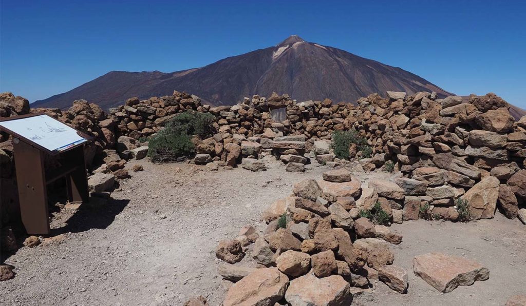
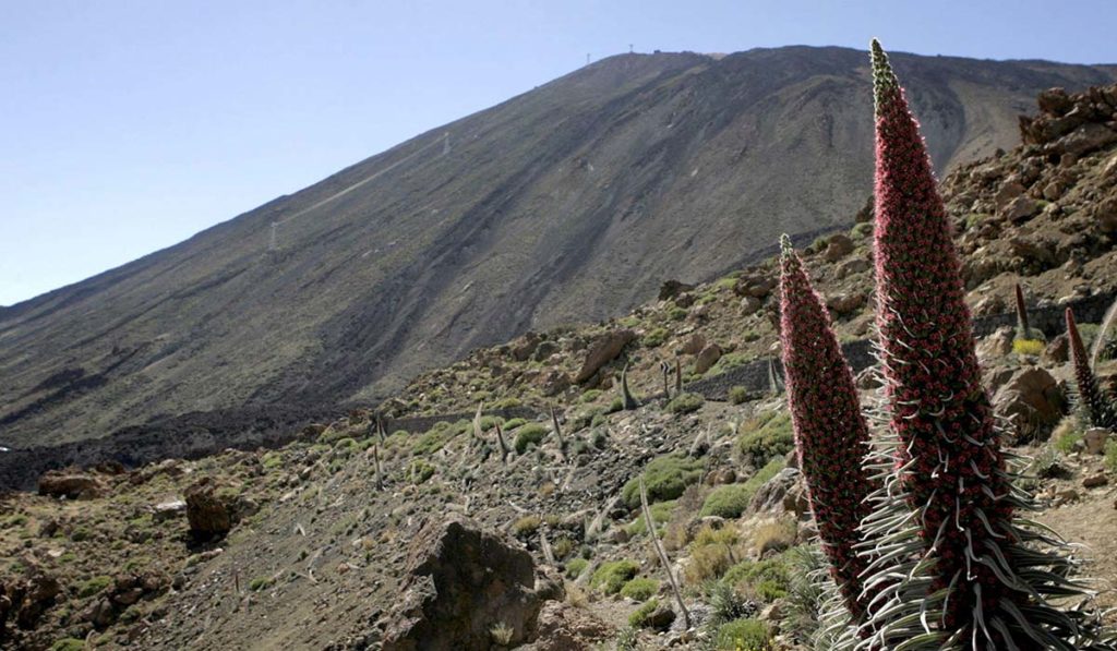
Seven Cañadas
Distance: 16.6 km
Duration: 4-5 hours
This trail begins at the Portillo Visitor Center and ends at the Cañada Blanca Visitor Center. In addition, it stands out for being a section of the old Chasna Road, which was used to go from the north to the south of Tenerife.
The route runs along a track along the wall of the Caldera de Las Cañadas, during which wonders of geology such as the fringes of basaltic black flows and the endemic species of the flora of Teide, such as the red tajinaste so characteristic of the area.
** The interactive route shown is a route proposed by a registered user in the popular Wikiloc application
Forest of Enigmas
Distance: 5 km
Duration: 4 hours
This trail runs through the heart of the Anaga Rural Park, declared Biosphere Reserve in 2015, being one of the best hiking trails in Tenerife without a doubt.
The Forest of Enigmas route is a simple circular route for the whole family. This trail can be started at the Mirador de Zapata and is done by spectacular laurel forests, with a distance of about 5 kilometers very well signposted and with very little unevenness. In addition, it is important to bring some warm clothing, since it is a fairly humid area.
** The interactive route shown is a route proposed by a registered user in the popular Wikiloc application
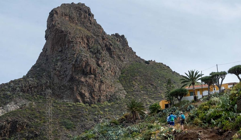
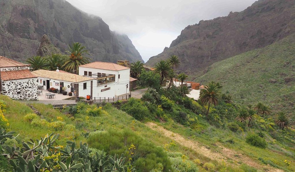
Masca ravine
Distance: 5 km (10 km descent and ascent)
Duration: 3 hours (descent) / 4 hours (ascent)
The Barranco de Masca trail is located within the Teno Massif and stands out for its spectacular geology, being a formation of basaltic lava. So much so that it is considered one of the best hiking trails in Tenerife and one of the most visited natural places on the island.
The route ends at a wild beach, where you can take a boat to the port of Los Gigantes, although currently the Masca pier is not operational, so the only alternative is to make the ascent by the same route.
To visit the Masca ravine, keep in mind that access is limited, so it is convenient to plan in advance. In addition, it is necessary to go through the Visitor Center before starting the descent, where the reservation is validated, the footwear and clothing are checked and a helmet is delivered for greater protection.
** The interactive route shown is a route proposed by a registered user in the popular Wikiloc application
You can also discover the best hiking trails in Tenerife from the perspective of Luis Espinosa García, one of the pioneers of mountaineering in the Canary Islands.


