
The town of Tasarte yesterday became the hottest spot in all of Spain with a temperature of 45.6 degrees Celsius and that was recorded at 15.40 hours in the Aemet meteorological station, which is located on Cruz Chica street in the main urban nucleus of this town of The Village of San Nicolás.
Rate you thus exceeded by five tenths the second mark of the day, targeted in Albox, Almería, all within a historic heat wave due to the numerous records that have been produced throughout the country since the end of last week.
Tasarte thus surpassed the second mark of the day by five tenths, set in Albox, Almería, all within a historical heat wave due to the numerous records that have been produced throughout the country since the end of last week.
The heat and the warning due to the speed of the air is added in all the coastlines that of coastal phenomena
The stream of high temperatures in the Canary Archipelago, which saw a red warning for the first time activated for the island of Tenerife since it was implemented the Meteoalerta system, within the National Plan for Prediction and Surveillance of Adverse Meteorological Phenomena, 15 years ago, as highlighted yesterday by the Canarian Television news program, and with a Tenerife south airport which boiled at more than 44 degrees Celsius, nevertheless made a special dent in the island of Gran Canaria, which monopolized five of the four maximums of the Autonomous Community, since Tasarte was added to the station of the Insular Tourism Center, in Maspalomas, with 43.5 degrees centigrade shortly after noon; Loins of Pedro Afonso, in the upper midlands of San Bartolomé de Tirajana, with 42.4; Y the town of Agüimes, It was touching 42 degrees at 1:20 p.m.
The minimums, which translate into figures the powerful intensity of this succession of tropical nights, are also worth highlighting. In the town of Agüimes itself the thermometer stuck at 33.6 degrees Celsius shortly after three thirty in the morning; in Lomos de Pedro Afonso at 32.7; and at the Telde Forest Center at 31.2 around four in the morning.
For this reason the warning map of the State Meteorological Agency painted yesterday, and it will do so today, in a document that has the value of the strangest banknotes, with the western half of La Palma, all the islands of El Hierro and La Gomera, the south of Tenerife and the south of Gran Canaria were under red warning due to high temperatures, while the rest of the areas were in orange. For today the panorama is similar although with nuances, since the two islands of La Gomera and El Hierro turn out of red and are in orange.
The Aemet forecasts that the heat will begin to subside between tomorrow and Thursday, but still with high values
In turn, all the alerts, whether health or environmental, are in force and will continue to be for several more days. All the islands, except the south of Fuerteventura, are also under the red color of extreme risk due to forest fire to which a pre-alert is added for the presence of haze.
Hence the strict prohibition of carrying out any activity in the natural environment and the recommendation of the authorities, as made public by the Cabildo de Gran Canaria, to avoid unnecessary travel to midlands and peaks to avoid dangers of forest fires.
Restrictions in force
Broadly speaking, the prohibitions in force are those of the use of fire in recreational areas, agricultural or forest burning, the practice of charcoal and the use of fire in beekeeping, as well as the firing of fireworks, highlighting from the island emergency services, that “the best extinction is the fire that does not occur.”
To these potentially percussive fire meteors, an added danger is added as of today with the increase in air speed, and consequently with the activation of the yellow warning due to very strong gusts in the northeast slopes, to which is added that of coastal phenomena.
Thus, the most detailed prediction of the state agency maintains the red warning in central hours today on the islands of Gran Canaria, La Palma and Tenerife, while leaving the rest of the area in orange also in those same central hours, all of this due to temperatures that could again exceed 40 degrees Celsius, but with more probability in La Gomera and El Hierro.
 “style =” width: 100%; height: auto; max-width: 100%; “height =” 495 “width =” 880 “alt =” “/>
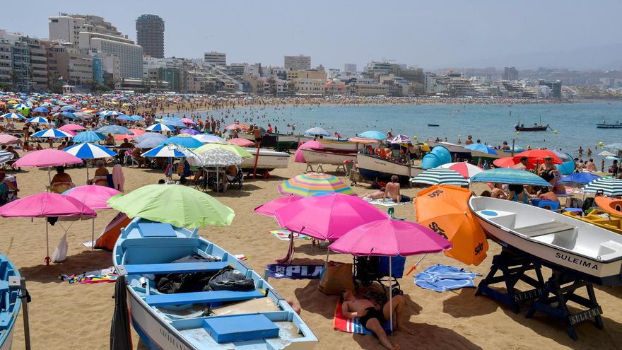
Nighttime values will also continue to be very high, easily exceeding 25 degrees and even 30. The wind, from the northeast, will come strong with very strong intervals in Lanzarote, Fuerteventura and the northwest and southeast peaks and slopes of the islands of greater relief. .
Already yesterday afternoon this increasing wind trend was reflected with the record of gusts of almost 80 kilometers per hour in the anemometer of the Tenerife South airport, as well as in La Aldea de San Nicolás, with 71 kilometers per hour.
For tomorrow, Wednesday, the only relief in the interior of Gran Canaria, especially in the southern slopes, focuses on the change from red to orange in the temperature warning, and now in yellow in the rest of the geography of the archipelago. In the same way, yellow is still in force due to coastal phenomena and winds, with the forecast of the arrival of very strong gusts from the northeast on the most mountainous islands.
Calima in height
The skies, one more day, will appear cloudy in the midlands due to the presence of haze but in general they will look clear with intervals of low clouds in the north of Gran Canaria as well as in the north and west of the most eastern islands when the fall of the night, and the general decrease in temperatures will become more palpable, which will hover around, and may even exceed, 34 degrees Celsius in the south and west in their average levels.
On Thursday, six days after the episode started, the thermometers will continue to drop gradually, although in some points they can repeat 34 degrees Celsius.
The suspended dust will also begin its retreat, with a slight presence in the high elevations, and the wind will again roll from the northeast and blow with more intensity on the northwest and southeast slopes, with the presence of breezes on the coasts oriented to the southwest of the islands of greater relief, always according to the prediction of the state agency.


